Misplaced Pages

List of islands of Namibia

Article snapshot taken from Wikipedia with creative commons attribution-sharealike license. Give it a read and then ask your questions in the chat. We can research this topic together.

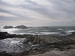
Halifax Island

Namibia has many islands. Here are some of them:

Penguin Islands

The Penguin Islands consist of:

From north to south:
Name coordinates
Hollam's Bird Island 24°38′S 14°31′E / 24.633°S 14.517°E / -24.633; 14.517 (Hollam's Bird Island)
Mercury Island 25°43′09″S 14°49′59″E / 25.719161°S 14.832948°E / -25.719161; 14.832948 (Mercury Island)
Ichaboe Island 25°43′S 14°50′E / 25.717°S 14.833°E / -25.717; 14.833 (Ichaboe Island)
Black Rock 26°05′S 14°58′E / 26.083°S 14.967°E / -26.083; 14.967 (Black Rock)
Staple Rock 26°22′S 14°58′E / 26.367°S 14.967°E / -26.367; 14.967 (Staple Rock)
Marshall Reef 26°22′S 14°58′E / 26.367°S 14.967°E / -26.367; 14.967 (Marshall Reef)
Boat Bay Rocks 26°25′S 15°5′E / 26.417°S 15.083°E / -26.417; 15.083 (Boat Bay Rocks)
Seal Island 26°36′S 15°9′E / 26.600°S 15.150°E / -26.600; 15.150 (Seal Island)
Penguin Island 26°37′S 15°9′E / 26.617°S 15.150°E / -26.617; 15.150 (Penguin Island)
Halifax Island 26°39′S 15°5′E / 26.650°S 15.083°E / -26.650; 15.083 (Halifax Island)
Graget Island 26°00′S 15°11′E / 26.000°S 15.183°E / -26.000; 15.183 (Graget Island)
Albatross Rock 27°07′S 15°13′E / 27.117°S 15.217°E / -27.117; 15.217 (Albatross Rock)
Possession Island 27°01′S 15°13′E / 27.017°S 15.217°E / -27.017; 15.217 (Possession Island)
Pomona Island 27°12′S 15°15′E / 27.200°S 15.250°E / -27.200; 15.250 (Pomona Island)
North Long Island 26°49′S 15°8′E / 26.817°S 15.133°E / -26.817; 15.133 (North Long Island)
South Long Island 26°50′S 15°8′E / 26.833°S 15.133°E / -26.833; 15.133 (South Long Island)
Black Rock 24°56′S 14°48′E / 24.933°S 14.800°E / -24.933; 14.800 (Black Rock)
Black Sophie Rock 27°38′S 15°31′E / 27.633°S 15.517°E / -27.633; 15.517 (Black Sophie Rock)
Plumpudding Island 27°38′S 15°32′E / 27.633°S 15.533°E / -27.633; 15.533 (Plumpudding Island)
Sinclair Island (Roast Beef Island) 27°40′S 15°32′E / 27.667°S 15.533°E / -27.667; 15.533 (Sinclair Island)
Little Roastbeef Islets 27°42′S 15°32′E / 27.700°S 15.533°E / -27.700; 15.533 (Little Roastbeef Islets)
Map all coordinates using OpenStreetMap

Download coordinates as:

List of islands of Africa
Sovereign states
States with limited
recognition
Dependencies and
other territories
Categories: