Map all coordinates using OpenStreetMap
Download coordinates as:
There are at least 20 named lakes and reservoirs in Benton County, Arkansas.
Lakes
According to the United States Geological Survey, there are no named lakes in Benton County.


Reservoirs
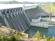
- Beaver Lake, 36°14′08″N 093°56′34″W / 36.23556°N 93.94278°W / 36.23556; -93.94278 (Beaver Lake), el. 1,122 feet (342 m)
- Bella Vista Lake, 36°26′00″N 094°13′25″W / 36.43333°N 94.22361°W / 36.43333; -94.22361 (Bella Vista Lake), el. 1,142 feet (348 m)
- Crystal Lake, 36°20′25″N 094°26′21″W / 36.34028°N 94.43917°W / 36.34028; -94.43917 (Crystal Lake), el. 1,165 feet (355 m)
- Guerrero Lake Number One, 36°17′53″N 094°29′53″W / 36.29806°N 94.49806°W / 36.29806; -94.49806 (Guerrero Lake Number One), el. 1,220 feet (370 m)
- Guerrero Lake Number Three, 36°18′30″N 094°29′14″W / 36.30833°N 94.48722°W / 36.30833; -94.48722 (Guerrero Lake Number Three), el. 1,191 feet (363 m)
- Gurrero Lake Number Two, 36°18′07″N 094°29′40″W / 36.30194°N 94.49444°W / 36.30194; -94.49444 (Gurrero Lake Number Two), el. 1,188 feet (362 m)
- Jackson Lake, 36°22′18″N 094°14′25″W / 36.37167°N 94.24028°W / 36.37167; -94.24028 (Jackson Lake), el. 1,211 feet (369 m)
- Lake Ann, 36°28′24″N 094°13′31″W / 36.47333°N 94.22528°W / 36.47333; -94.22528 (Lake Ann), el. 1,053 feet (321 m)
- Lake Atalanta, 36°20′16″N 094°05′54″W / 36.33778°N 94.09833°W / 36.33778; -94.09833 (Lake Atalanta), el. 1,214 feet (370 m)
- Lake Avalon, 36°28′24″N 094°15′43″W / 36.47333°N 94.26194°W / 36.47333; -94.26194 (Lake Avalon), el. 1,066 feet (325 m)
- Lake Bentonville, 36°21′07″N 094°13′10″W / 36.35194°N 94.21944°W / 36.35194; -94.21944 (Lake Bentonville), el. 1,276 feet (389 m)
- Lake Brittany, 36°28′03″N 094°12′04″W / 36.46750°N 94.20111°W / 36.46750; -94.20111 (Lake Brittany), el. 1,201 feet (366 m)
- Lake Flint Creek, 36°15′05″N 094°32′03″W / 36.25139°N 94.53417°W / 36.25139; -94.53417 (Lake Flint Creek), el. 1,135 feet (346 m)
- Lake Frances, 36°07′48″N 094°33′53″W / 36.13000°N 94.56472°W / 36.13000; -94.56472 (Lake Frances), el. 906 feet (276 m)
- Lake Keith, 36°15′42″N 094°14′01″W / 36.26167°N 94.23361°W / 36.26167; -94.23361 (Lake Keith), el. 1,135 feet (346 m)
- Lake Norwood, 36°28′36″N 094°14′55″W / 36.47667°N 94.24861°W / 36.47667; -94.24861 (Lake Norwood), el. 1,007 feet (307 m)
- Lake Rayburn, 36°27′36″N 094°14′49″W / 36.46000°N 94.24694°W / 36.46000; -94.24694 (Lake Rayburn), el. 994 feet (303 m)
- Lake Windsor, 36°28′12″N 094°15′31″W / 36.47000°N 94.25861°W / 36.47000; -94.25861 (Lake Windsor), el. 1,070 feet (330 m)
- Siloam Springs Lake, 36°13′29″N 094°32′19″W / 36.22472°N 94.53861°W / 36.22472; -94.53861 (Siloam Springs Lake), el. 1,043 feet (318 m)
- Upper Pond, 36°21′00″N 094°17′43″W / 36.35000°N 94.29528°W / 36.35000; -94.29528 (Upper Pond), el. 1,270 feet (390 m)
See also
Notes
- "Beaver Lake". Geographic Names Information System. United States Geological Survey, United States Department of the Interior.
- "Bella Vista Lake". Geographic Names Information System. United States Geological Survey, United States Department of the Interior.
- "Crystal Lake". Geographic Names Information System. United States Geological Survey, United States Department of the Interior.
- "Guerrero Lake Number One". Geographic Names Information System. United States Geological Survey, United States Department of the Interior.
- "Guerrero Lake Number Three". Geographic Names Information System. United States Geological Survey, United States Department of the Interior.
- "Gurrero Lake Number Two". Geographic Names Information System. United States Geological Survey, United States Department of the Interior.
- "Jackson Lake". Geographic Names Information System. United States Geological Survey, United States Department of the Interior.
- "Lake Ann". Geographic Names Information System. United States Geological Survey, United States Department of the Interior.
- "Lake Atalanta". Geographic Names Information System. United States Geological Survey, United States Department of the Interior.
- "Lake Avalon". Geographic Names Information System. United States Geological Survey, United States Department of the Interior.
- "Lake Bentonville". Geographic Names Information System. United States Geological Survey, United States Department of the Interior.
- "Lake Brittany". Geographic Names Information System. United States Geological Survey, United States Department of the Interior.
- "Lake Flint Creek". Geographic Names Information System. United States Geological Survey, United States Department of the Interior.
- "Lake Frances". Geographic Names Information System. United States Geological Survey, United States Department of the Interior.
- "Lake Keith". Geographic Names Information System. United States Geological Survey, United States Department of the Interior.
- "Lake Norwood". Geographic Names Information System. United States Geological Survey, United States Department of the Interior.
- "Lake Rayburn". Geographic Names Information System. United States Geological Survey, United States Department of the Interior.
- "Lake Windsor". Geographic Names Information System. United States Geological Survey, United States Department of the Interior.
- "Siloam Springs Lake". Geographic Names Information System. United States Geological Survey, United States Department of the Interior.
- "Upper Pond". Geographic Names Information System. United States Geological Survey, United States Department of the Interior.
| Municipalities and communities of Benton County, Arkansas, United States | ||
|---|---|---|
| County seat: Bentonville | ||
| Cities |  | |
| Towns | ||
| Townships | ||
| CDPs | ||
| Other communities | ||
| Ghost towns | ||
| Footnotes | ‡This populated place also has portions in an adjacent county or counties Bethel Heights, a former municipality, is now a part of Springdale | |