| Name
|
Location
|
Date Listed
|
Grid Ref.
|
Geo-coordinates
|
Notes
|
LB Number
|
Image
|
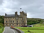
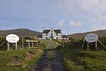
| Scalpay, Eilean Glas Lighthouse, Old Lighthouse, Store And Enclosure Wall, Keeper's Cottages, Outbuildings, Jetty And Foghorn
|
|
|
|
57°51′26″N 6°38′20″W / 57.857108°N 6.638994°W / 57.857108; -6.638994 (Scalpay, Eilean Glas Lighthouse, Old Lighthouse, Store And Enclosure Wall, Keeper's Cottages, Outbuildings, Jetty And Foghorn)
|
Category A
|
13487
|
 Upload another image
See more images
|
| Rodel, Building At Ngr Ng 0461/8330
|
|
|
|
57°44′31″N 6°57′56″W / 57.741976°N 6.965682°W / 57.741976; -6.965682 (Rodel, Building At Ngr Ng 0461/8330)
|
Category B
|
12908
|

Upload Photo
|
| Amhuinnsuidhe, Screen Walls, Gates And Gatepiers, To East Of Mansion
|
|
|
|
57°57′48″N 6°59′42″W / 57.963372°N 6.99511°W / 57.963372; -6.99511 (Amhuinnsuidhe, Screen Walls, Gates And Gatepiers, To East Of Mansion)
|
Category B
|
12746
|

Upload Photo
|
| Amhuinnsuidhe, Boathouse
|
|
|
|
57°57′53″N 6°59′51″W / 57.964769°N 6.997557°W / 57.964769; -6.997557 (Amhuinnsuidhe, Boathouse)
|
Category B
|
12749
|

Upload Photo
|
| Tarbert, West Loch, House At Pier
|
|
|
|
57°54′00″N 6°48′52″W / 57.900072°N 6.814475°W / 57.900072; -6.814475 (Tarbert, West Loch, House At Pier)
|
Category C(S)
|
12602
|

Upload Photo
|
| Berneray Thatched Cottage At Laimrig Ruadh At Os Grid Reference Nf 92957 81549
|
|
|
|
57°43′06″N 7°09′31″W / 57.718384°N 7.158612°W / 57.718384; -7.158612 (Berneray Thatched Cottage At Laimrig Ruadh At Os Grid Reference Nf 92957 81549)
|
Category B
|
46100
|

Upload Photo
|
| Berneray Thatched Cottage At Baile (Gatliffe Trust)
|
|
|
|
57°43′02″N 7°09′14″W / 57.71733°N 7.154006°W / 57.71733; -7.154006 (Berneray Thatched Cottage At Baile (Gatliffe Trust))
|
Category B
|
46103
|

Upload Photo
|
| Berneray Risgary Barn And Byre
|
|
|
|
57°43′06″N 7°09′14″W / 57.71831°N 7.154011°W / 57.71831; -7.154011 (Berneray Risgary Barn And Byre)
|
Category B
|
46108
|

Upload Photo
|
| Berneray Parish Church
|
|
|
|
57°43′12″N 7°10′29″W / 57.71995°N 7.174642°W / 57.71995; -7.174642 (Berneray Parish Church)
|
Category C(S)
|
49877
|

Upload Photo
|
| Rodel, Building At Ngr Ng 0493/8286
|
|
|
|
57°44′18″N 6°57′36″W / 57.738306°N 6.959946°W / 57.738306; -6.959946 (Rodel, Building At Ngr Ng 0493/8286)
|
Category C(S)
|
12909
|

Upload Photo
|
| Ardseilhb/Manish School And Schoolhouse
|
|
|
|
57°48′06″N 6°52′01″W / 57.801618°N 6.867006°W / 57.801618; -6.867006 (Ardseilhb/Manish School And Schoolhouse)
|
Category B
|
12750
|

Upload Photo
|
| Aline, Roadbridge (A859 Over Amhainn A'Mhuil)
|
|
|
|
58°00′28″N 6°45′10″W / 58.007905°N 6.752853°W / 58.007905; -6.752853 (Aline, Roadbridge (A859 Over Amhainn A'Mhuil))
|
Category C(S)
|
12766
|

Upload Photo
|
| Berneray Davaar Cottage (At Pol An Oir)
|
|
|
|
57°42′39″N 7°10′38″W / 57.710813°N 7.177168°W / 57.710813; -7.177168 (Berneray Davaar Cottage (At Pol An Oir))
|
Category C(S)
|
46097
|

Upload Photo
|
| Berneray Thatched Cottages At Os Grid Reference Nf 9272 8186 And Nf 9272 8187
|
|
|
|
57°43′16″N 7°09′47″W / 57.721023°N 7.16294°W / 57.721023; -7.16294 (Berneray Thatched Cottages At Os Grid Reference Nf 9272 8186 And Nf 9272 8187)
|
Category B
|
46098
|

Upload Photo
|
| Berneray Thatched Cottage At Laimrig Ruadh At Os Grid Reference Nf 9296 8157
|
|
|
|
57°43′07″N 7°09′31″W / 57.718674°N 7.158553°W / 57.718674; -7.158553 (Berneray Thatched Cottage At Laimrig Ruadh At Os Grid Reference Nf 9296 8157)
|
Category B
|
46101
|

Upload Photo
|
| Berneray Thatched Cottage At Laimrig Ruadh At Os Grid Reference Nf 9294 8159
|
|
|
|
57°43′08″N 7°09′32″W / 57.718785°N 7.158905°W / 57.718785; -7.158905 (Berneray Thatched Cottage At Laimrig Ruadh At Os Grid Reference Nf 9294 8159)
|
Category B
|
46102
|

Upload Photo
|
| Ardvourlie Castle Including Garden Terrace Walls, Slipway And Bridge
|
|
|
|
57°59′41″N 6°45′29″W / 57.994843°N 6.758148°W / 57.994843; -6.758148 (Ardvourlie Castle Including Garden Terrace Walls, Slipway And Bridge)
|
Category B
|
49675
|

Upload Photo
|
| Tarbert, The Pier, Tarbert Stores
|
|
|
|
57°53′51″N 6°47′55″W / 57.897624°N 6.79862°W / 57.897624; -6.79862 (Tarbert, The Pier, Tarbert Stores)
|
Category C(S)
|
50799
|

Upload Photo
|
| The Golden Road, Meavaig South, Muilinn Mhiabhaig (Meavag Mill)
|
|
|
|
57°52′01″N 6°48′17″W / 57.866863°N 6.804661°W / 57.866863; -6.804661 (The Golden Road, Meavaig South, Muilinn Mhiabhaig (Meavag Mill))
|
Category C(S)
|
50801
|

Upload Photo
|
| Leverburgh Water Tower
|
|
|
|
57°46′04″N 7°01′10″W / 57.767816°N 7.019408°W / 57.767816; -7.019408 (Leverburgh Water Tower)
|
Category B
|
12906
|

Upload Photo
|
| Rodel Harbour, Quays, Piers And Crane
|
|
|
|
57°44′16″N 6°57′40″W / 57.737643°N 6.961016°W / 57.737643; -6.961016 (Rodel Harbour, Quays, Piers And Crane)
|
Category B
|
12910
|

Upload Photo
|
| Rodel St Clement's Church And Churchyard
|
|
|
|
57°44′27″N 6°57′47″W / 57.740938°N 6.963033°W / 57.740938; -6.963033 (Rodel St Clement's Church And Churchyard)
|
Category A
|
12912
|
 Upload another image
|
| Amhuinnsuidhe, Former Kennels
|
|
|
|
57°57′47″N 6°59′42″W / 57.962971°N 6.995004°W / 57.962971; -6.995004 (Amhuinnsuidhe, Former Kennels)
|
Category C(S)
|
12748
|

Upload Photo
|
| Berneray Former Parliamentary Church
|
|
|
|
57°43′22″N 7°09′26″W / 57.722755°N 7.157117°W / 57.722755; -7.157117 (Berneray Former Parliamentary Church)
|
Category B
|
46106
|
 Upload another image
See more images
|
| 1 Fleoideabhagh (Flodabay)
|
|
|
|
57°47′50″N 6°53′01″W / 57.79709°N 6.883648°W / 57.79709; -6.883648 (1 Fleoideabhagh (Flodabay))
|
Category C(S)
|
50802
|

Upload Photo
|
| Tarbert, Free Presbyterian Church
|
|
|
|
57°53′54″N 6°47′50″W / 57.898256°N 6.797133°W / 57.898256; -6.797133 (Tarbert, Free Presbyterian Church)
|
Category B
|
12866
|

Upload Photo
|
| Tarbert Primary School And Schoolhouse
|
|
|
|
57°54′04″N 6°48′46″W / 57.901144°N 6.812777°W / 57.901144; -6.812777 (Tarbert Primary School And Schoolhouse)
|
Category B
|
12867
|

Upload Photo
|
| Amhuinnsuidhe, Mansion House, Including Sea-Walls And Retaining Walls
|
|
|
|
57°57′41″N 6°59′26″W / 57.961379°N 6.990431°W / 57.961379; -6.990431 (Amhuinnsuidhe, Mansion House, Including Sea-Walls And Retaining Walls)
|
Category A
|
12767
|
 Upload another image
|
| Berneray Thatched Cottage At Baile At Os Grid Reference Nf 9315 8140
|
|
|
|
57°43′02″N 7°09′18″W / 57.717224°N 7.15505°W / 57.717224; -7.15505 (Berneray Thatched Cottage At Baile At Os Grid Reference Nf 9315 8140)
|
Category B
|
46104
|

Upload Photo
|
| Berneray Former Parliamentary Manse
|
|
|
|
57°43′27″N 7°09′25″W / 57.724153°N 7.157013°W / 57.724153; -7.157013 (Berneray Former Parliamentary Manse)
|
Category B
|
46107
|

Upload Photo
|
| Scaristamore Scarista House Including Outbuilding
|
|
|
|
57°49′30″N 7°02′31″W / 57.825054°N 7.041851°W / 57.825054; -7.041851 (Scaristamore Scarista House Including Outbuilding)
|
Category B
|
12863
|
 Upload another image
|
| Tarbert, Church Of Scotland Manse
|
|
|
|
57°53′50″N 6°47′50″W / 57.897116°N 6.797285°W / 57.897116; -6.797285 (Tarbert, Church Of Scotland Manse)
|
Category C(S)
|
12865
|

Upload Photo
|
| Amhuinnsuidhe, Archway And Adjoining Buildings, Including, Cottages
|
|
|
|
57°57′42″N 6°59′31″W / 57.961721°N 6.992019°W / 57.961721; -6.992019 (Amhuinnsuidhe, Archway And Adjoining Buildings, Including, Cottages)
|
Category B
|
12747
|
 Upload another image
|
| Horsacleit
|
|
|
|
57°51′53″N 6°49′23″W / 57.864708°N 6.823008°W / 57.864708; -6.823008 (Horsacleit)
|
Category B
|
12752
|

Upload Photo
|
| Manish Former Free Church Manse
|
|
|
|
57°47′53″N 6°52′47″W / 57.797919°N 6.879666°W / 57.797919; -6.879666 (Manish Former Free Church Manse)
|
Category C(S)
|
12755
|

Upload Photo
|
| Berneray Thatched Cottage At Baile At Os Grid Reference Nf 9314 8138
|
|
|
|
57°43′01″N 7°09′19″W / 57.717072°N 7.155264°W / 57.717072; -7.155264 (Berneray Thatched Cottage At Baile At Os Grid Reference Nf 9314 8138)
|
Category B
|
46105
|

Upload Photo
|
| Rodel Hotel
|
|
|
|
57°44′18″N 6°57′46″W / 57.738447°N 6.962758°W / 57.738447; -6.962758 (Rodel Hotel)
|
Category B
|
12911
|

Upload Photo
|
| Tarbert, Church Of Scotland
|
|
|
|
57°53′49″N 6°47′46″W / 57.897036°N 6.796092°W / 57.897036; -6.796092 (Tarbert, Church Of Scotland)
|
Category C(S)
|
12864
|

Upload Photo
|
| The Golden Road, No 9A Quidinish
|
|
|
|
57°46′49″N 6°54′02″W / 57.780331°N 6.900595°W / 57.780331; -6.900595 (The Golden Road, No 9A Quidinish)
|
Category B
|
50800
|

Upload Photo
|
| Leverburgh Water Reservoir
|
|
|
|
57°46′05″N 7°01′10″W / 57.76797°N 7.019396°W / 57.76797; -7.019396 (Leverburgh Water Reservoir)
|
Category B
|
12907
|

Upload Photo
|
| Manish Free Church
|
|
|
|
57°47′53″N 6°52′48″W / 57.798029°N 6.880068°W / 57.798029; -6.880068 (Manish Free Church)
|
Category B
|
12754
|

Upload Photo
|
| Tarbert, West Loch, Pier
|
|
|
|
57°54′02″N 6°49′02″W / 57.900622°N 6.817286°W / 57.900622; -6.817286 (Tarbert, West Loch, Pier)
|
Category C(S)
|
12604
|

Upload Photo
|
| Berneray Thatched Cottage At Os Grid Reference Nf 9276 8182
|
|
|
|
57°43′15″N 7°09′44″W / 57.720771°N 7.162282°W / 57.720771; -7.162282 (Berneray Thatched Cottage At Os Grid Reference Nf 9276 8182)
|
Category C(S)
|
46099
|

Upload Photo
|
| Scaristamore, Harris Parish Church
|
|
|
|
57°49′27″N 7°02′32″W / 57.824119°N 7.042276°W / 57.824119; -7.042276 (Scaristamore, Harris Parish Church)
|
Category B
|
13488
|

Upload Photo
|


