| Name
|
Location
|
Date Listed
|
Grid Ref.
|
Geo-coordinates
|
Notes
|
LB Number
|
Image
|
| Berriedale 2, Mill House
|
|
|
|
58°11′01″N 3°29′59″W / 58.183706°N 3.499779°W / 58.183706; -3.499779 (Berriedale 2, Mill House)
|
Category C(S)
|
7921
|

Upload Photo
|
| Berriedale 1, 2, 3, Portland Terrace
|
|
|
|
58°10′57″N 3°29′55″W / 58.182535°N 3.498522°W / 58.182535; -3.498522 (Berriedale 1, 2, 3, Portland Terrace)
|
Category C(S)
|
7923
|

Upload Photo
|
| Berriedale, The White House (Former Church Of Scotland Manse)
|
|
|
|
58°11′10″N 3°29′54″W / 58.18621°N 3.498456°W / 58.18621; -3.498456 (Berriedale, The White House (Former Church Of Scotland Manse))
|
Category C(S)
|
7927
|

Upload Photo
|
| Latheron Post Office And Adjoining Terrace
|
|
|
|
58°17′00″N 3°22′01″W / 58.283378°N 3.366924°W / 58.283378; -3.366924 (Latheron Post Office And Adjoining Terrace)
|
Category B
|
7929
|

Upload Photo
|
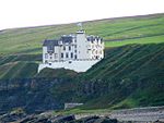
| Dunbeath Castle, Walled Gardens and Garden Pavilion
|
|
|
|
58°14′06″N 3°26′08″W / 58.235026°N 3.43559°W / 58.235026; -3.43559 (Dunbeath Castle, Walled Gardens and Garden Pavilion)
|
Category A
|
7936
|
 Upload another image
See more images
|
| Dunbeath, The Village (Macewen And Farquhar)
|
|
|
|
58°14′58″N 3°25′53″W / 58.249391°N 3.431485°W / 58.249391; -3.431485 (Dunbeath, The Village (Macewen And Farquhar))
|
Category C(S)
|
7942
|

Upload Photo
|
| Gillivoan House
|
|
|
|
58°17′19″N 3°22′10″W / 58.288498°N 3.369492°W / 58.288498; -3.369492 (Gillivoan House)
|
Category B
|
7950
|

Upload Photo
|
| Lybster Harbour Inver House
|
|
|
|
58°17′50″N 3°17′32″W / 58.297215°N 3.29227°W / 58.297215; -3.29227 (Lybster Harbour Inver House)
|
Category B
|
7956
|

Upload Photo
|
| Lybster Main Street (Grey Place) "Ornum" And G D Munro
|
|
|
|
58°18′06″N 3°17′06″W / 58.301653°N 3.285111°W / 58.301653; -3.285111 (Lybster Main Street (Grey Place) "Ornum" And G D Munro)
|
Category C(S)
|
7961
|

Upload Photo
|
| Lybster Main Street (Grey Place) 2, 3, 6 Main Street (No 6 Gowanlea) And House Right Of Gowanlea
|
|
|
|
58°18′09″N 3°17′05″W / 58.302383°N 3.284831°W / 58.302383; -3.284831 (Lybster Main Street (Grey Place) 2, 3, 6 Main Street (No 6 Gowanlea) And House Right Of Gowanlea)
|
Category C(S)
|
7966
|

Upload Photo
|
| Lybster Quatre Bras C & A Ross Shop And Dwelling
|
|
|
|
58°18′31″N 3°17′08″W / 58.308556°N 3.285532°W / 58.308556; -3.285532 (Lybster Quatre Bras C & A Ross Shop And Dwelling)
|
Category C(S)
|
7998
|

Upload Photo
|
| Nottingham Mains Steading
|
|
|
|
58°18′02″N 3°20′27″W / 58.300586°N 3.340884°W / 58.300586; -3.340884 (Nottingham Mains Steading)
|
Category B
|
8000
|

Upload Photo
|
| Berriedale Shore Cottages
|
|
|
|
58°11′00″N 3°29′48″W / 58.183221°N 3.496748°W / 58.183221; -3.496748 (Berriedale Shore Cottages)
|
Category C(S)
|
7924
|
 Upload another image
See more images
|
| Berriedale Shore, Fishing Store And Ice House
|
|
|
|
58°10′59″N 3°29′51″W / 58.183115°N 3.497373°W / 58.183115; -3.497373 (Berriedale Shore, Fishing Store And Ice House)
|
Category C(S)
|
7925
|

Upload Photo
|
| Berriedale Church Of Scotland And Burial Ground
|
|
|
|
58°11′22″N 3°29′48″W / 58.18951°N 3.496655°W / 58.18951; -3.496655 (Berriedale Church Of Scotland And Burial Ground)
|
Category B
|
7926
|
 Upload another image
See more images
|
| Bridge Of Achavar, Over Clyth Burn
|
|
|
|
58°19′06″N 3°15′37″W / 58.318437°N 3.26025°W / 58.318437; -3.26025 (Bridge Of Achavar, Over Clyth Burn)
|
Category C(S)
|
7930
|
 Upload another image
|
| Braemore Lodge
|
|
|
|
58°15′10″N 3°35′12″W / 58.252812°N 3.586757°W / 58.252812; -3.586757 (Braemore Lodge)
|
Category B
|
7934
|
 Upload another image
|
| Dunbeath Castle Gate Lodge And Gate Piers
|
|
|
|
58°14′27″N 3°26′35″W / 58.240753°N 3.443129°W / 58.240753; -3.443129 (Dunbeath Castle Gate Lodge And Gate Piers)
|
Category B
|
7938
|

Upload Photo
|
| Forse House Gate Lodge And Gate Piers
|
|
|
|
58°17′25″N 3°20′32″W / 58.290261°N 3.342097°W / 58.290261; -3.342097 (Forse House Gate Lodge And Gate Piers)
|
Category C(S)
|
7948
|
 Upload another image
|
| Lybster Main Street (Grey Place) 2-4, 8 And 9 (No 9 "Shangri La")
|
|
|
|
58°18′08″N 3°17′05″W / 58.302115°N 3.284736°W / 58.302115; -3.284736 (Lybster Main Street (Grey Place) 2-4, 8 And 9 (No 9 "Shangri La"))
|
Category C(S)
|
7967
|

Upload Photo
|
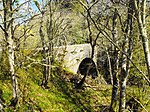
| Latheronwheel Bridge Over Burn Of Latheronwheel (On A9 Road)
|
|
|
|
58°16′43″N 3°23′23″W / 58.278651°N 3.389626°W / 58.278651; -3.389626 (Latheronwheel Bridge Over Burn Of Latheronwheel (On A9 Road))
|
Category B
|
7985
|
 Upload another image
|
| Lybster Quatre Bras
|
|
|
|
58°18′28″N 3°17′08″W / 58.307892°N 3.285491°W / 58.307892; -3.285491 (Lybster Quatre Bras)
|
Category B
|
7999
|

Upload Photo
|
| Latheron Former Schoolhouse, School And Walls
|
|
|
|
58°17′01″N 3°22′00″W / 58.283553°N 3.366538°W / 58.283553; -3.366538 (Latheron Former Schoolhouse, School And Walls)
|
Category B
|
7928
|

Upload Photo
|
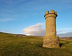
| Berriedale Pair Navigation Beacon Towers
|
|
|
|
58°10′52″N 3°29′54″W / 58.181012°N 3.498203°W / 58.181012; -3.498203 (Berriedale Pair Navigation Beacon Towers)
|
Category B
|
7931
|
 Upload another image
|
| The Corr
|
|
|
|
58°18′10″N 3°21′45″W / 58.302676°N 3.362412°W / 58.302676; -3.362412 (The Corr)
|
Category A
|
7935
|

Upload Photo
|
| Dunbeath The Village Mrs Mackay's House And Tigh A Mhuilinn (Lindsay)
|
|
|
|
58°14′57″N 3°25′52″W / 58.249305°N 3.431141°W / 58.249305; -3.431141 (Dunbeath The Village Mrs Mackay's House And Tigh A Mhuilinn (Lindsay))
|
Category C(S)
|
7941
|

Upload Photo
|
| Dunbeath, Portomin Harbour, Fishing Store And Ice House
|
|
|
|
58°14′45″N 3°25′23″W / 58.245722°N 3.423006°W / 58.245722; -3.423006 (Dunbeath, Portomin Harbour, Fishing Store And Ice House)
|
Category B
|
7945
|

Upload Photo
|
| Lybster Harbour At Invershore
|
|
|
|
58°17′45″N 3°17′29″W / 58.295921°N 3.291438°W / 58.295921; -3.291438 (Lybster Harbour At Invershore)
|
Category B
|
7954
|
 Upload another image
See more images
|
| Lybster Main Street (West Side) Buchollie House
|
|
|
|
58°17′57″N 3°17′04″W / 58.299224°N 3.284563°W / 58.299224; -3.284563 (Lybster Main Street (West Side) Buchollie House)
|
Category C(S)
|
7958
|

Upload Photo
|
| Lybster Main Street (West Side) The Yarrows And 3-7 (Inclusive Nos) Russell Street
|
|
|
|
58°18′04″N 3°17′07″W / 58.301228°N 3.285386°W / 58.301228; -3.285386 (Lybster Main Street (West Side) The Yarrows And 3-7 (Inclusive Nos) Russell Street)
|
Category C(S)
|
7960
|

Upload Photo
|
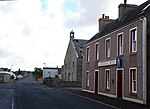
| Lybster Main Street (Grey Place) (East Side) Commercial Hotel
|
|
|
|
58°18′09″N 3°17′05″W / 58.302491°N 3.284818°W / 58.302491; -3.284818 (Lybster Main Street (Grey Place) (East Side) Commercial Hotel)
|
Category C(S)
|
7965
|
 Upload another image
|
| Latheron Wheel (Janetstown) Craiglea
|
|
|
|
58°16′35″N 3°23′06″W / 58.276464°N 3.385072°W / 58.276464; -3.385072 (Latheron Wheel (Janetstown) Craiglea)
|
Category C(S)
|
7982
|

Upload Photo
|
| Buldoo Bell Tower
|
|
|
|
58°17′08″N 3°21′44″W / 58.285648°N 3.362133°W / 58.285648; -3.362133 (Buldoo Bell Tower)
|
Category B
|
10950
|
 Upload another image
|
| Swiney House
|
|
|
|
58°17′46″N 3°18′23″W / 58.296003°N 3.306402°W / 58.296003; -3.306402 (Swiney House)
|
Category B
|
8003
|

Upload Photo
|
| Berriedale 1 Mill House
|
|
|
|
58°11′01″N 3°30′00″W / 58.183704°N 3.499983°W / 58.183704; -3.499983 (Berriedale 1 Mill House)
|
Category C(S)
|
7933
|

Upload Photo
|
| Dunbeath Hotel
|
|
|
|
58°14′58″N 3°25′55″W / 58.249582°N 3.432055°W / 58.249582; -3.432055 (Dunbeath Hotel)
|
Category C(S)
|
7944
|

Upload Photo
|
| Forse House Hotel
|
|
|
|
58°17′59″N 3°20′41″W / 58.299602°N 3.344771°W / 58.299602; -3.344771 (Forse House Hotel)
|
Category B
|
7946
|
 Upload another image
|
| Forse House Hotel, Small House To Rear And Walled Garden
|
|
|
|
58°18′00″N 3°20′38″W / 58.299925°N 3.343948°W / 58.299925; -3.343948 (Forse House Hotel, Small House To Rear And Walled Garden)
|
Category B
|
7947
|
 Upload another image
|
| Lybster Ha' Store And Garden Walls
|
|
|
|
58°18′33″N 3°16′34″W / 58.309197°N 3.27622°W / 58.309197; -3.27622 (Lybster Ha' Store And Garden Walls)
|
Category C(S)
|
7957
|

Upload Photo
|
| Lybster Main Street, (Grey Place) A H Sinclair Shop And Dwelling
|
|
|
|
58°18′06″N 3°17′07″W / 58.301787°N 3.28515°W / 58.301787; -3.28515 (Lybster Main Street, (Grey Place) A H Sinclair Shop And Dwelling)
|
Category C(S)
|
7962
|

Upload Photo
|
| Berriedale, 2 Bridges Over Berriedale And Langwell Waters
|
|
|
|
58°11′03″N 3°30′05″W / 58.184209°N 3.501365°W / 58.184209; -3.501365 (Berriedale, 2 Bridges Over Berriedale And Langwell Waters)
|
Category C(S)
|
7968
|

Upload Photo
|
| Berriedale War Memorial, Berriedale
|
|
|
|
58°11′02″N 3°30′04″W / 58.183959°N 3.501235°W / 58.183959; -3.501235 (Berriedale War Memorial, Berriedale)
|
Category B
|
7969
|
 Upload another image
See more images
|
| Latheron Wheel House
|
|
|
|
58°16′27″N 3°23′50″W / 58.274238°N 3.39733°W / 58.274238; -3.39733 (Latheron Wheel House)
|
Category B
|
7980
|

Upload Photo
|
| Lybster Main Street Craigard (L) And Milton (R)
|
|
|
|
58°18′01″N 3°17′03″W / 58.300242°N 3.284224°W / 58.300242; -3.284224 (Lybster Main Street Craigard (L) And Milton (R))
|
Category B
|
7996
|

Upload Photo
|
| Dunbeath, Salmon Bothy
|
|
|
|
58°14′42″N 3°25′17″W / 58.245014°N 3.421257°W / 58.245014; -3.421257 (Dunbeath, Salmon Bothy)
|
Category B
|
42894
|

Upload Photo
|
| Lybster, Main Street, (Grey's Place, East Side) Church Of Scotland, (St Mary's Church)
|
|
|
|
58°18′10″N 3°17′05″W / 58.302797°N 3.284743°W / 58.302797; -3.284743 (Lybster, Main Street, (Grey's Place, East Side) Church Of Scotland, (St Mary's Church))
|
Category B
|
10951
|

Upload Photo
|
| Ousdale Farmhouse
|
|
|
|
58°09′34″N 3°34′52″W / 58.159565°N 3.581192°W / 58.159565; -3.581192 (Ousdale Farmhouse)
|
Category C(S)
|
8002
|

Upload Photo
|
| Berriedale, Saw Mill
|
|
|
|
58°11′01″N 3°29′57″W / 58.183552°N 3.499143°W / 58.183552; -3.499143 (Berriedale, Saw Mill)
|
Category B
|
7922
|

Upload Photo
|
| Dunbeath Castle Dovecote
|
|
|
|
58°14′29″N 3°26′40″W / 58.241458°N 3.444333°W / 58.241458; -3.444333 (Dunbeath Castle Dovecote)
|
Category B
|
7939
|

Upload Photo
|
| Laidhay Croft Museum Croft House And Barn
|
|
|
|
58°15′21″N 3°24′33″W / 58.255773°N 3.409265°W / 58.255773; -3.409265 (Laidhay Croft Museum Croft House And Barn)
|
Category A
|
7951
|
 Upload another image
See more images
|
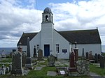
| Latheron Old Parish Church And Burial Ground
|
|
|
|
58°16′53″N 3°21′43″W / 58.28125°N 3.361845°W / 58.28125; -3.361845 (Latheron Old Parish Church And Burial Ground)
|
Category B
|
7952
|
 Upload another image
See more images
|
| Forse House Dovecote
|
|
|
|
58°17′59″N 3°20′49″W / 58.299742°N 3.346841°W / 58.299742; -3.346841 (Forse House Dovecote)
|
Category A
|
7949
|

Upload Photo
|
| Lybster Harbour, Fishery Office
|
|
|
|
58°17′48″N 3°17′32″W / 58.296704°N 3.292183°W / 58.296704; -3.292183 (Lybster Harbour, Fishery Office)
|
Category C(S)
|
7955
|

Upload Photo
|
| Latheronwheel, (Janetstown) Cooper's Buildings
|
|
|
|
58°16′22″N 3°22′45″W / 58.272781°N 3.379251°W / 58.272781; -3.379251 (Latheronwheel, (Janetstown) Cooper's Buildings)
|
Category B
|
7984
|

Upload Photo
|
| Berriedale, Welbeck Estate, Ivy Cottage And Laundry
|
|
|
|
58°11′06″N 3°30′06″W / 58.18488°N 3.501597°W / 58.18488; -3.501597 (Berriedale, Welbeck Estate, Ivy Cottage And Laundry)
|
Category B
|
50836
|

Upload Photo
|
| Berriedale, Welbeck Estate Office, Berriedale Post Office And Stable/Byre Range
|
|
|
|
58°11′05″N 3°30′06″W / 58.184754°N 3.501592°W / 58.184754; -3.501592 (Berriedale, Welbeck Estate Office, Berriedale Post Office And Stable/Byre Range)
|
Category B
|
7932
|

Upload Photo
|
| Dunbeath Castle, Stable Court
|
|
|
|
58°14′11″N 3°26′22″W / 58.236419°N 3.439563°W / 58.236419; -3.439563 (Dunbeath Castle, Stable Court)
|
Category B
|
7937
|

Upload Photo
|
| Lybster Main Street, (Grey Place) Post Office And "Greymouth"
|
|
|
|
58°18′07″N 3°17′07″W / 58.301867°N 3.285187°W / 58.301867; -3.285187 (Lybster Main Street, (Grey Place) Post Office And "Greymouth")
|
Category C(S)
|
7963
|

Upload Photo
|
| Latheronwheel (Janetstown) Barn/Store Immediately West Of Craiglea
|
|
|
|
58°16′35″N 3°23′08″W / 58.276496°N 3.385449°W / 58.276496; -3.385449 (Latheronwheel (Janetstown) Barn/Store Immediately West Of Craiglea)
|
Category B
|
7983
|

Upload Photo
|
| Latheronwheel (Janetstown) Harbour Bridge Over Burn Of Latheronwheel
|
|
|
|
58°16′16″N 3°22′59″W / 58.271034°N 3.383036°W / 58.271034; -3.383036 (Latheronwheel (Janetstown) Harbour Bridge Over Burn Of Latheronwheel)
|
Category C(S)
|
7986
|
 Upload another image
See more images
|
| Lybster Main Street (Grey Place) (East Side) Dwelling And Shop D Munro
|
|
|
|
58°18′07″N 3°17′04″W / 58.301847°N 3.284521°W / 58.301847; -3.284521 (Lybster Main Street (Grey Place) (East Side) Dwelling And Shop D Munro)
|
Category C(S)
|
7995
|

Upload Photo
|
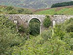
| Ousdale Bridge Over The Ousdale Burn
|
|
|
|
58°09′43″N 3°35′22″W / 58.162059°N 3.589444°W / 58.162059; -3.589444 (Ousdale Bridge Over The Ousdale Burn)
|
Category C(S)
|
8001
|
 Upload another image
|
| Swiney, Miss Lillie's House
|
|
|
|
58°18′03″N 3°18′28″W / 58.300857°N 3.30781°W / 58.300857; -3.30781 (Swiney, Miss Lillie's House)
|
Category C(S)
|
8004
|

Upload Photo
|
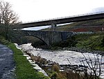
| Dunbeath Bridge Over The Dunbeath Water (On A9 Road)
|
|
|
|
58°14′58″N 3°25′58″W / 58.249321°N 3.432879°W / 58.249321; -3.432879 (Dunbeath Bridge Over The Dunbeath Water (On A9 Road))
|
Category B
|
7940
|
 Upload another image
|
| Dunbeath, The Village Murray M Smythe Shop
|
|
|
|
58°14′58″N 3°25′54″W / 58.24947°N 3.431658°W / 58.24947; -3.431658 (Dunbeath, The Village Murray M Smythe Shop)
|
Category C(S)
|
7943
|

Upload Photo
|
| Latheron, Former Free Church Manse, Steading And Garden Walls
|
|
|
|
58°17′04″N 3°22′08″W / 58.28449°N 3.368757°W / 58.28449; -3.368757 (Latheron, Former Free Church Manse, Steading And Garden Walls)
|
Category C(S)
|
7953
|

Upload Photo
|
| Lybster, Main Street, (West Side) Clydesdale Bank
|
|
|
|
58°18′03″N 3°17′06″W / 58.300782°N 3.28508°W / 58.300782; -3.28508 (Lybster, Main Street, (West Side) Clydesdale Bank)
|
Category B
|
7959
|
 Upload another image
|
| Lybster Main Street (Grey Place) C Macdonald
|
|
|
|
58°18′07″N 3°17′07″W / 58.30202°N 3.285193°W / 58.30202; -3.285193 (Lybster Main Street (Grey Place) C Macdonald)
|
Category C(S)
|
7964
|

Upload Photo
|
| Braemore Bridge Over The Berriedale Water
|
|
|
|
58°15′10″N 3°34′54″W / 58.25265°N 3.581672°W / 58.25265; -3.581672 (Braemore Bridge Over The Berriedale Water)
|
Category B
|
7970
|
 Upload another image
See more images
|
| Latheron Wheel (Janets Town) Melbourne
|
|
|
|
58°16′35″N 3°23′05″W / 58.27637°N 3.38466°W / 58.27637; -3.38466 (Latheron Wheel (Janets Town) Melbourne)
|
Category C(S)
|
7981
|

Upload Photo
|
| Lybster Portland Arms
|
|
|
|
58°18′30″N 3°17′11″W / 58.308449°N 3.286331°W / 58.308449; -3.286331 (Lybster Portland Arms)
|
Category C(S)
|
7997
|
 Upload another image
|


