Map all coordinates using OpenStreetMap
Download coordinates as:
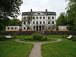
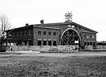
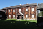
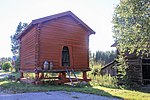
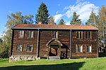
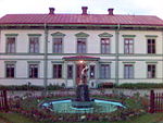
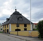
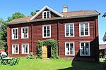
There are 101 listed buildings (Swedish: byggnadsminne) in Gävleborg County.
Bollnäs Municipality
| Image | Name | Premises | Number of buildings |
Year built | Architect | Coordinates | ID |
|---|---|---|---|---|---|---|---|

|
Gästgivars | Vallsta 1:2 | 10 | 61°31′56″N 16°22′03″E / 61.53231°N 16.36751°E / 61.53231; 16.36751 | 21000001714750 | ||
| Rehnstedts | Ren 30:404 | 1 | 61°21′14″N 16°26′45″E / 61.35391°N 16.44577°E / 61.35391; 16.44577 | 21300000012226 | |||
| Renshammar | Ren 15:11 Previously 15:1 |
3 | 61°21′18″N 16°25′31″E / 61.35499°N 16.42540°E / 61.35499; 16.42540 | 21300000012225 | |||

|
Styfstorpet | Voxsätter 4:30 | 7 | 61°18′37″N 16°26′08″E / 61.31041°N 16.43564°E / 61.31041; 16.43564 | 21300000012466 | ||
| Västansjö ullspinneri | Västansjö 4:4 | 1 | 61°11′44″N 16°27′07″E / 61.19555°N 16.45208°E / 61.19555; 16.45208 | 21300000012341 | |||

|
Växbo kvarn | Växbo 15:2 | 4 | 61°24′20″N 16°33′19″E / 61.40548°N 16.55529°E / 61.40548; 16.55529 | 21300000012237 |
Gävle Municipality
Hofors Municipality
| Image | Name | Premises | Number of buildings |
Year built | Architect | Coordinates | ID |
|---|---|---|---|---|---|---|---|
| Erkas | Åsmundshyttan 12:7 | 5 | 60°28′41″N 16°27′57″E / 60.47817°N 16.46580°E / 60.47817; 16.46580 | 21300000012408 |
Hudiksvall Municipality
Ljusdal Municipality
Nordanstig Municipality
| Image | Name | Premises | Number of buildings |
Year built | Architect | Coordinates | ID |
|---|---|---|---|---|---|---|---|

|
Ersk-Mats | Lindsjön 1:13 | 13 | 62°10′25″N 16°30′36″E / 62.17356°N 16.51005°E / 62.17356; 16.51005 | 21300000012295 | ||
| Svensgård | Å 3:2 | 7 | 61°58′54″N 17°15′43″E / 61.98167°N 17.26191°E / 61.98167; 17.26191 | 21300000023807 |
Ockelbo Municipality
| Image | Name | Premises | Number of buildings |
Year built | Architect | Coordinates | ID |
|---|---|---|---|---|---|---|---|
| Brattfors bruk | Brattfors 1:4, 1:8 Böle S:9, 1:49-50, 1:52-53, 1:55 previously Brattfors bruk 1:1 Åkerby 1:1 |
10 | 60°50′36″N 16°39′57″E / 60.84338°N 16.66597°E / 60.84338; 16.66597 | 21300000012395 | |||

|
Wij valsverk | Vi 1:150 | 1 | 60°53′03″N 16°42′22″E / 60.88415°N 16.70617°E / 60.88415; 16.70617 | 21300000012397 |
Ovanåker Municipality
Sandviken Municipality
| Image | Name | Premises | Number of buildings |
Year built | Architect | Coordinates | ID |
|---|---|---|---|---|---|---|---|
| Mjölnargården i Gavelhyttan | Nor 10:2 | 5 | 60°33′34″N 16°36′42″E / 60.55954°N 16.61174°E / 60.55954; 16.61174 | 21300000012400 | |||
| Nygårds | Bro 3:7 | 16 | 60°36′32″N 16°28′47″E / 60.60887°N 16.47982°E / 60.60887; 16.47982 | 21300000020255 | |||
| Riksdagsmans | Åsen 1:87 | 1 | 60°36′29″N 16°36′08″E / 60.60795°N 16.60223°E / 60.60795; 16.60223 | 21300000012403 |
Söderhamn Municipality
External links
- (in Swedish) Bebyggelseregistret
