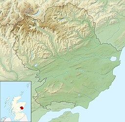
Freshwater loch in Angus, Scotland
| Loch Fithie | |
|---|---|
 | |
| Location | Angus, Scotland |
| Coordinates | 56°39′4″N 2°50′1″W / 56.65111°N 2.83361°W / 56.65111; -2.83361 |
| Type | freshwater loch |
| Primary inflows | on the eastern shore |
| Primary outflows | no outflow |
| Basin countries | Scotland |
| Max. length | 1.6 km (1 mi) |
| Max. width | 140 m (150 yd) |
| Surface area | 7.1 ha (18 acres) |
| Average depth | 2.3 m (7.5 ft) |
| Max. depth | 4.9 m (16 ft) |
| Water volume | 200,000 m (7,000,000 cu ft) |
| Shore length | 1.4 km (0.87 mi) |
| Surface elevation | 67 m (220 ft) |
| Islands | 0 |
| Shore length is not a well-defined measure. | |
Loch Fithie is a small, lowland freshwater loch lying approximately 2 miles (3.2 km) east of Forfar, Scotland. It is approximately 800 m (2,600 ft) in length.
Survey
The loch was surveyed on 30 June 1903 by Sir John Murray and later charted as part of Murray's Bathymetrical Survey of Fresh-Water Lochs of Scotland 1897-1909.
History
To the northwest of the loch are the remains of the Augustinian Restenneth Priory. In 1954, a stone axe head was found during excavations of a gravel ridge at the loch.
References
- ^ "Loch Fithie". British lakes. British Lakes. Retrieved 3 January 2015.
- ^ "Bathymetrical Survey of the Fresh-Water Lochs of Scotland, 1897-1909, Lochs of the Lunan Basin". National Library of Scotland. Retrieved 3 January 2015.
- "Lochs Fithie, Rescobie and Balgavies (Vol. 5, Plate 51) - Bathymetrical Survey, 1897-1909 - National Library of Scotland". National Library of Scotland. Retrieved 3 January 2015.
- "Loch Fithie : cist and axe head". Canmore. Retrieved 3 January 2015.
This Angus location article is a stub. You can help Misplaced Pages by expanding it. |