Village in England
| Longframlington | |
|---|---|
| Village | |
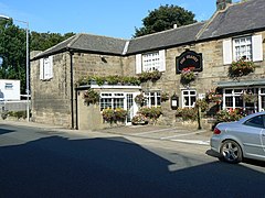
 The Granby Inn, Longframlington The Granby Inn, Longframlington | |
 | |
| Population | 1,360 (2021 census) |
| OS grid reference | NU135005 |
| Shire county | |
| Region | |
| Country | England |
| Sovereign state | United Kingdom |
| Post town | MORPETH |
| Postcode district | NE65 |
| Police | Northumbria |
| Fire | Northumberland |
| Ambulance | North East |
| UK Parliament | |
| |
Longframlington is a small village in Northumberland, England, located on the A697, 11 miles (18 km) north-west of Morpeth and 5 miles (8 km) south-east of Rothbury. Longframlington is a former pit village and on the site of the pit now stands Fram Park, a log cabin holiday park. The village was previously the site of the Longframlington Music Festival.
Landmarks
A branch of the Roman road, Dere Street, known as the Devil's Causeway, passes close by Longframlington en route to Berwick-upon-Tweed, and the mounds visible on the Hall Hill in the angle of the Pauperhaugh and Weldon Bridge roads may be those of a Roman camp.
Embleton Hall is a country manor house which was built around 1730 and is a Grade II listed building.
Longframlington has a Tank Turn in the local park, used during WW2.
Religious sites
The church of St Mary the Virgin dates from the late 12th century and until 1891 was a chapel of ease to Felton; since that date Longframlington has been an independent parish. The church was carefully restored in the late 19th century retaining its fine Norman chancel arch. The church is identified as being dedicated to St. Laurence on maps of Longframlington shown on website Communities.Northumberland.gov.uk (Longframlington - Ordnance maps) dated 1897 and 1920.
References
- "Longframlington (Northumberland, North East England, United Kingdom) - Population Statistics, Charts, Map, Location, Weather and Web Information".
- Hugill, Robert (1931). Road Guide to Northumberland and The Border. Newcastle upon Tyne, England: Andrew Reid & Company, Limited.
- Historic England. "Embleton Hall (1154981)". National Heritage List for England. Retrieved 19 March 2020.
- St Mary the Virgin Retrieved 17 November 2008
External links
- The Swarland Chronicles: Independent Online Magazine
- GENUKI (Accessed: 17 November 2008)
- Northumberland Communities (Accessed: 17 November 2008)
| This article needs additional citations for verification. Please help improve this article by adding citations to reliable sources. Unsourced material may be challenged and removed. Find sources: "Longframlington" – news · newspapers · books · scholar · JSTOR (July 2007) (Learn how and when to remove this message) |
This Northumberland location article is a stub. You can help Misplaced Pages by expanding it. |