| Lumpkin Hill | |
|---|---|
 Georgia State Route 20 goes over the summit of Lumpkin Hill Georgia State Route 20 goes over the summit of Lumpkin Hill | |
| Highest point | |
| Elevation | 640 ft (200 m) |
| Coordinates | 34°15′32″N 85°09′59″W / 34.2589824°N 85.1663393°W / 34.2589824; -85.1663393 |
| Geography | |
 | |
| Location | Rome, Georgia, U.S. |
| Topo map(s) | USGS Rome North, GA |
| Climbing | |
| Easiest route | Drive |
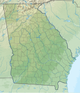
Lumpkin Hill is a summit in Rome, Georgia. With an elevation of 640 feet (200 m), Lumpkin Hill is the 914th highest summit in the state of Georgia. The hill is considered to be one of the Seven Hills of Rome, Georgia.
The summit was named for John Henry Lumpkin, who is also buried on the hill. In 1956, Lumpkin Hill's peak was leveled during the construction of Turner McCall Boulevard.
References
- ^ "Lumpkin Hill". Peakery.com. Retrieved 25 April 2015.
- ^ U.S. Geological Survey Geographic Names Information System: Lumpkin Hill
- United States Geological Survey (March 19, 2018). North Rome, GA quadrangle (Topographic map). Reston, VA: United States Geological Survey. Retrieved March 19, 2018 – via TopoQuest.
- ^ Wilson, CC. The Seven Hills of Rome. RomeGeorgia.com. 23 February 2002. Retrieved 17 March 2018.
- Denmon, Shirley. The Enchanted Land Eighth Hill. (2012). pp. 5. ISBN 9781452089553
- "Floyd County". Calhoun Times. September 1, 2004. p. 76. Retrieved 24 April 2015.
This Floyd County, Georgia state location article is a stub. You can help Misplaced Pages by expanding it. |