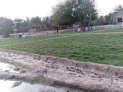
| Malook Wali | |
|---|---|
| Village | |
| Malook Wali | |
 Village Out Side Village Out Side | |
  | |
| Coordinates: 28°08′13.3″N 69°32′17.3″E / 28.137028°N 69.538139°E / 28.137028; 69.538139 | |
| Country | |
| Province | |
| District | Ghotki District |
| Elevation | 74 m (243 ft) |
| Population | |
| • Total | 2,559 |
| Time zone | UTC+5 (PST) |
Malook Wali (Urdu: ملوک والی, Sindhi: ملوڪ والي) is a village in district Ghotki North side of the Mirpur Mathelo its zip code is 65041 it is located at 28°08'13.3"N 69°32'17.3"E
References
- "Village Malook Wali". pak.postcodebase.com. Retrieved 2019-04-23.
- "Malook Wali". pk.geoview.info. Retrieved 2019-07-29.
| Populated places in Ghotki District | |
|---|---|
| Talukas | |
| Cities and towns | |
| Villages | |
This Sindh location article is a stub. You can help Misplaced Pages by expanding it. |