CDP in South Dakota, United States
| Manderson-White Horse Creek, South Dakota Oyúȟpe | |
|---|---|
| CDP | |
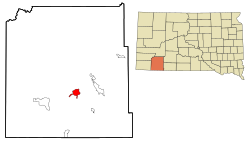
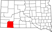
 Location in Oglala Lakota County and the state of South Dakota Location in Oglala Lakota County and the state of South Dakota | |
| Coordinates: 43°14′06″N 102°29′29″W / 43.23500°N 102.49139°W / 43.23500; -102.49139 | |
| Country | United States |
| State | South Dakota |
| County | Oglala Lakota |
| Civil township | East Oglala Lakota Unorganized Territory |
| Area | |
| • Total | 5.73 sq mi (14.85 km) |
| • Land | 5.73 sq mi (14.85 km) |
| • Water | 0.00 sq mi (0.00 km) |
| Elevation | 3,248 ft (990 m) |
| Population | |
| • Total | 554 |
| • Density | 96.63/sq mi (37.31/km) |
| Time zone | UTC-7 (Mountain (MST)) |
| • Summer (DST) | UTC-6 (MDT) |
| Area code | 605 |
| FIPS code | 46-40550 |
| GNIS feature ID | 2393117 |
Manderson-White Horse Creek (Lakota: oyúȟpe; the name of a band of the Oglala) is a census-designated place (CDP) in East Oglala Lakota Unorganized Territory (civil township equivalent) in Oglala Lakota County, South Dakota, United States. The population was 554 at the 2020 census. Oglala Lakota tribesman, Kicking Bear died here on May 28, 1904. He fought in several battles during the Black Hills War, including Battle of the Greasy Grass. His nephew, Felix Flying Hawk owned a ranch.
According to the Federal Writers' Project, the origin of the name Manderson is obscure.
Geography
According to the United States Census Bureau, the CDP has a total area of 5.7 square miles or 14.8 square kilometres, all land.
Climate
Like most of South Dakota, Manderson has a relatively dry humid continental climate (Köppen Dfa) with summers featuring very warm to hot afternoons and pleasant mornings, and generally freezing, though very variable, winters. Winter weather, like all of the West River region is dominated by the extreme temperature conflicts between warm chinook winds that bring temperatures above 50 °F or 10 °C on an average of seventeen afternoons during the three winter months, and cold Arctic air that brings an average of 19.5 mornings below 0 °F or −17.8 °C. The dryness of the winter limits snowfall and the chinooks further limit snow depth, which exceeds 1 inch or 0.025 metres on only 41.8 days each year.
Summer weather is generally very warm, although during dry spells when the upper-level anticyclone moves northward, long periods of sweltering and arid weather may occur: the hottest month was August 1983 with a daily mean of 78.6 °F or 25.9 °C and the hottest temperature on record 110 °F or 43.3 °C on July 2 of 1990.
| Climate data for Manderson 3 NE, South Dakota (1971-2000), extremes 1949-2001 | |||||||||||||
|---|---|---|---|---|---|---|---|---|---|---|---|---|---|
| Month | Jan | Feb | Mar | Apr | May | Jun | Jul | Aug | Sep | Oct | Nov | Dec | Year |
| Record high °F (°C) | 66 (19) |
70 (21) |
82 (28) |
93 (34) |
95 (35) |
105 (41) |
110 (43) |
104 (40) |
102 (39) |
93 (34) |
83 (28) |
69 (21) |
110 (43) |
| Mean daily maximum °F (°C) | 34.8 (1.6) |
40.6 (4.8) |
48.3 (9.1) |
58.3 (14.6) |
68.0 (20.0) |
78.7 (25.9) |
86.8 (30.4) |
87.0 (30.6) |
77.2 (25.1) |
64.0 (17.8) |
46.4 (8.0) |
37.6 (3.1) |
60.6 (15.9) |
| Daily mean °F (°C) | 22.9 (−5.1) |
28.4 (−2.0) |
36.7 (2.6) |
45.9 (7.7) |
56.2 (13.4) |
66.3 (19.1) |
73.1 (22.8) |
72.6 (22.6) |
62.2 (16.8) |
49.7 (9.8) |
34.2 (1.2) |
25.6 (−3.6) |
47.8 (8.8) |
| Mean daily minimum °F (°C) | 11.0 (−11.7) |
16.2 (−8.8) |
25.0 (−3.9) |
33.5 (0.8) |
44.4 (6.9) |
53.8 (12.1) |
59.4 (15.2) |
58.1 (14.5) |
47.2 (8.4) |
35.3 (1.8) |
21.9 (−5.6) |
13.6 (−10.2) |
35.0 (1.7) |
| Record low °F (°C) | −28 (−33) |
−31 (−35) |
−18 (−28) |
5 (−15) |
23 (−5) |
33 (1) |
38 (3) |
37 (3) |
19 (−7) |
−8 (−22) |
−19 (−28) |
−37 (−38) |
−37 (−38) |
| Average precipitation inches (mm) | 0.39 (9.9) |
0.46 (12) |
1.32 (34) |
2.20 (56) |
3.16 (80) |
3.18 (81) |
2.58 (66) |
1.87 (47) |
1.51 (38) |
1.52 (39) |
0.70 (18) |
0.41 (10) |
19.3 (490.9) |
| Average snowfall inches (cm) | 6.9 (18) |
6.1 (15) |
10.8 (27) |
3.5 (8.9) |
0.4 (1.0) |
0.0 (0.0) |
0.0 (0.0) |
0.0 (0.0) |
trace | 3.5 (8.9) |
6.1 (15) |
7.0 (18) |
44.3 (113) |
| Average precipitation days (≥ 0.01 inch) | 4.5 | 4.6 | 7.1 | 9.1 | 10.6 | 10.0 | 7.8 | 6.1 | 5.9 | 5.5 | 4.9 | 5.5 | 81.6 |
| Average snowy days (≥ 0.1 inch) | 3.8 | 2.8 | 3.6 | 1.6 | 0.1 | 0.0 | 0.0 | 0.0 | 0.0 | 1.1 | 2.9 | 3.8 | 19.7 |
| Source: | |||||||||||||
Demographics
| Census | Pop. | Note | %± |
|---|---|---|---|
| 1990 | 243 | — | |
| 2000 | 626 | 157.6% | |
| 2010 | 626 | 0.0% | |
| 2020 | 554 | −11.5% | |
| U.S. Decennial Census | |||
As of the census of 2000, there were 626 people, 109 households, and 97 families residing in the CDP. The population density was 109.9 inhabitants per square mile (42.4/km). There were 116 housing units at an average density of 20.4/sq mi (7.9/km). The racial makeup of the CDP was 1.12% White, 98.72% Native American, and 0.16% from two or more races. Hispanic or Latino of any race were 1.76% of the population.
There were 109 households, out of which 61.5% had children under the age of 18 living with them, 30.3% were married couples living together, 48.6% had a female householder with no husband present, and 10.1% were non-families. 9.2% of all households were made up of individuals, and 1.8% had someone living alone who was 65 years of age or older. The average household size was 5.70 and the average family size was 5.99.
In the CDP, the population was spread out, with 52.9% under the age of 18, 10.9% from 18 to 24, 22.0% from 25 to 44, 10.9% from 45 to 64, and 3.4% who were 65 years of age or older. The median age was 17 years. For every 100 females, there were 100.0 males. For every 100 females age 18 and over, there were 83.2 males.
The median income for a household in the CDP was $8,229, and the median income for a family was $8,229. Males had a median income of $13,750 versus $13,750 for females. The per capita income for the CDP was $4,440. About 75.9% of families and 74.6% of the population were below the poverty line, including 92.3% of those under age 18 and 57.9% of those age 65 or over.
See also
References
- "ArcGIS REST Services Directory". United States Census Bureau. Retrieved October 15, 2022.
- ^ U.S. Geological Survey Geographic Names Information System: Manderson-White Horse Creek, South Dakota
- ^ "Census Population API". United States Census Bureau. Retrieved October 15, 2022.
- ^ "U.S. Census website". United States Census Bureau. Retrieved January 31, 2008.
- Ullrich, Jan F. (2014). New Lakota Dictionary (2nd ed.). Bloomington, IN: Lakota Language Consortium. ISBN 978-0-9761082-9-0. Archived from the original on October 18, 2016. Retrieved February 12, 2014.
- "U.S. Census Bureau: Manderson-White Horse Creek CDP, South Dakota". www.census.gov. United States Census Bureau. Retrieved May 28, 2022.
- Federal Writers' Project (1940). South Dakota place-names, v.1-3. University of South Dakota. p. 49. Archived from the original on October 27, 2016.
- "Climatography of the United States NO.81" (PDF). National Oceanic and Atmospheric Administration. Retrieved January 30, 2023.
External links
- Sustainable Homestead Designs a project to create sustainable housing on the Pine Ridge Indian Reservation
- House Alive Cob House Building Workshop in Manderson, SD
| Municipalities and communities of Oglala Lakota County, South Dakota, United States | ||
|---|---|---|
| County seat: Hot Springs | ||
| Town |  | |
| CDPs | ||
| Unincorporated communities | ||
| Indian reservation | ||
| Footnotes | ‡This populated place also has portions in an adjacent county or counties | |
| Pine Ridge Indian Reservation | |||||
|---|---|---|---|---|---|
| Populated places |
| ||||
| History | |||||
| Education | |||||
| Transportation | |||||
| |||||