| Manga | |
|---|---|
 Indian Day in Manga (2017) Indian Day in Manga (2017) | |
  | |
| Coordinates: 3°43′27″N 51°43′17″W / 3.7242°N 51.7214°W / 3.7242; -51.7214 | |
| Country | |
| Region | North |
| State | Amapá |
| Municipality | Oiapoque |
| Government | |
| • Cacique | Luciano Iaparrá |
| Population | |
| • Total | 1,075 |
| Time zone | UTC-3 |
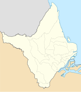
Manga is an Amerindian village of the Karipuna do Amapá people in the Brazilian municipality of Oiapoque, Amapá. It is the largest village of the tribe. Manga is located on the Caripi River in the Uaçá Indigenous Territory.
Overview
Manga is located in an area which was disputed between French Guiana and Brazil. In the 19th century, Amerindian people from several tribes and non-indigenous people settled in the neutral territory. In 1900, the territory was awarded to Brazil, however the main language spoken in Manga is Karipúna French Creole.
In 1976, a school was established in Manga where the children were taught in Portuguese In 1996, bilingual education was provided. The village has a clinic, and a community house.
Manga can be accessed via an unpaved road which connects to the BR-156 highway. Electricity is provided using Diesel generators. In 2015 work started on a hydro-electric power station in Oiapoque which will also supply electricity for Manga. In 2018, Manga hosted a three-day meeting of the indigenous people in the Brazilian, French Guianan and Surinamese region.
References
- "Ação de governo marca comemorações do Dia do Índio no Amapá". Governo do Estado do Amapá (in Brazilian Portuguese). Retrieved 29 March 2021.
- "Caracterização do DSEI Amapá e Norte do Pará, conforme Edital de Chamada Pública n. 2/2017" (PDF). Ministry of Health (Brazil) (in Portuguese). Retrieved 29 March 2021.
- ^ "Karipuna do Amapá". Socio Ambiental. Retrieved 28 March 2021.
- Gonçalves Fonseca 2019, p. 37.
- ^ Gonçalves Fonseca 2019, p. 81.
- Gonçalves Fonseca 2019, p. 48.
- Gonçalves Fonseca 2019, pp. 53–54.
- "Dsei Ap Polo Base de Saúde Indigena Manga - Aldeia - Oiapoque - AP - Unidade de Atenção A Saúde Indigena". Unidades de Saúde do Brasil (in Portuguese). Retrieved 29 March 2021.
- "Ramal da Aldeia do Manga, em Oiapoque, recebe serviços de manutenção e conservação". Diário do Amapá (in Portuguese). Retrieved 29 March 2021.
- "Energia em Oiapoque será gerada por hidrelétrica de pequeno porte em 2019". Amazonia.org (in Portuguese). Retrieved 29 March 2021.
- "Pueblos indígenas de las fronteras Brasil-Guyana Francesa-Surinam se articulan para oponerse juntos a los grandes proyectos económicos que se imponen en la región". Red Amazonia (in Portuguese). Retrieved 29 March 2021.
Bibliography
- Gonçalves Fonseca, Mary (2019). Currículo e construção da identidade Karipuna na Aldeia Manga, Amapá (Thesis). São Paulo: Pontifical Catholic University of São Paulo.
This Amapá, Brazil location article is a stub. You can help Misplaced Pages by expanding it. |