Place in Northland Region, New Zealand
| Mangawhai Heads | |
|---|---|
 Mangawhai Heads Mangawhai Heads | |
| Coordinates: 36°05′42″S 174°35′10″E / 36.095°S 174.586°E / -36.095; 174.586 | |
| Country | New Zealand |
| Region | Northland Region |
| District | Kaipara District |
| Ward | Kaiwaka-Mangawhai Ward |
| Electorates | |
| Government | |
| • Territorial Authority | Kaipara District Council |
| • Regional council | Northland Regional Council |
| • Mayor of Kaipara | Craig Jepson |
| • Northland MP | Grant McCallum |
| • Te Tai Tokerau MP | Mariameno Kapa-Kingi |
| Area | |
| • Total | 6.99 km (2.70 sq mi) |
| Population | |
| • Total | 2,850 |
| • Density | 410/km (1,100/sq mi) |
Mangawhai Heads is a township in Northland, New Zealand. Waipu is 21 kilometres northwest, and Mangawhai is 5 kilometres southwest. Mangawhai Heads is on the north shore of the Mangawhai Harbour.
Geography
The Mangawhai Cliffs Walkway, north of the township, is 4.5 kilometres long walk to Paepae-o-Tū / Bream Tail, and has a lookout point.
Mangawhai Heads Beach is an intermediate-level surf beach.
History
The Mangawhai Harbour is a part of the rohe of Te Uri-o-Hau, a tribal group either seen as an independent iwi, or as a hapū of Ngāti Whātua. The name refers to Te Whai, a historic rangatira of Ngāti Whātua, who shares his name with the short-tail stingray, whai, found in the harbour. Te Whai had a fortified pā at Mangawhai Point, a central headland in the harbour.
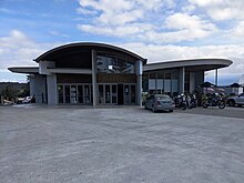
Mangawhai Museum, opened in 2014, features displays on the area's local history.
A new subdivision called The Rise or Mangawhai North is planned northwest of the existing settlement.
Demographics
Mangawhai Heads covers 6.99 km (2.70 sq mi) and had an estimated population of 2,850 as of June 2024, with a population density of 408 people per km.
| Year | Pop. | ±% p.a. |
|---|---|---|
| 2006 | 927 | — |
| 2013 | 1,239 | +4.23% |
| 2018 | 1,995 | +10.00% |
| 2023 | 2,685 | +6.12% |
| Source: | ||


Mangawhai Heads had a population of 2,685 in the 2023 New Zealand census, an increase of 690 people (34.6%) since the 2018 census, and an increase of 1,446 people (116.7%) since the 2013 census. There were 1,314 males, 1,359 females and 12 people of other genders in 1,101 dwellings. 2.1% of people identified as LGBTIQ+. The median age was 51.0 years (compared with 38.1 years nationally). There were 429 people (16.0%) aged under 15 years, 303 (11.3%) aged 15 to 29, 1,077 (40.1%) aged 30 to 64, and 876 (32.6%) aged 65 or older.
People could identify as more than one ethnicity. The results were 92.1% European (Pākehā); 13.1% Māori; 2.8% Pasifika; 3.8% Asian; 0.9% Middle Eastern, Latin American and African New Zealanders (MELAA); and 2.5% other, which includes people giving their ethnicity as "New Zealander". English was spoken by 98.3%, Māori language by 2.0%, Samoan by 0.2%, and other languages by 7.8%. No language could be spoken by 1.3% (e.g. too young to talk). New Zealand Sign Language was known by 0.3%. The percentage of people born overseas was 21.9, compared with 28.8% nationally.
Religious affiliations were 28.6% Christian, 0.7% Hindu, 0.2% Islam, 0.1% Māori religious beliefs, 0.6% Buddhist, 0.4% New Age, 0.2% Jewish, and 0.7% other religions. People who answered that they had no religion were 62.3%, and 6.3% of people did not answer the census question.
Of those at least 15 years old, 402 (17.8%) people had a bachelor's or higher degree, 1,263 (56.0%) had a post-high school certificate or diploma, and 489 (21.7%) people exclusively held high school qualifications. The median income was $34,400, compared with $41,500 nationally. 261 people (11.6%) earned over $100,000 compared to 12.1% nationally. The employment status of those at least 15 was that 855 (37.9%) people were employed full-time, 351 (15.6%) were part-time, and 51 (2.3%) were unemployed.
Notes
- ^ "ArcGIS Web Application". statsnz.maps.arcgis.com. Retrieved 9 May 2022.
- "Aotearoa Data Explorer". Statistics New Zealand. Retrieved 26 October 2024.
- "Mangawhai Cliffs Walkway". Department of Conservation. Retrieved 18 May 2020.
- Carlson, Liz (7 April 2018). "Mangawhai Heads offers peace, quiet and rugged scenery". Stuff.
- Janssen, Peter (January 2021). Greater Auckland Walks. New Holland Publishers. p. 18-19. ISBN 978-1-86966-516-6. OL 34023249W. Wikidata Q118136068.
- "Mangawhai Heads". Surf Seeker NZ. Retrieved 18 May 2020.
- ^ Kaipara District Council (May 2020). Mangawhai Coastal Walkway (PDF) (Report). Retrieved 3 May 2023.
- "Mangawhai roll of honour board". nzhistory.govt.nz. Ministry for Culture and Heritage.
- "Mangawhai Museum". Mangawhai Museum.
- "Mangawhai Museum on NZ Museums". nzmuseums.co.nz. Te Papa.
- Piper, Denise (6 November 2024). "Beach town Mangawhai to get another 380 houses with The Rise development". Northern Advocate.
- "Aotearoa Data Explorer". Statistics New Zealand. Retrieved 26 October 2024.
- "Statistical area 1 dataset for 2018 Census". Statistics New Zealand. March 2020. Mangawhai Heads (109900). 2018 Census place summary: Mangawhai Heads
- ^ "Totals by topic for individuals, (RC, TALB, UR, SA3, SA2, Ward, Health), 2013, 2018, and 2023 Censuses". Stats NZ – Tatauranga Aotearoa – Aotearoa Data Explorer. Mangawhai Heads (1063). Retrieved 3 October 2024.
- "Totals by topic for dwellings, (RC, TALB, UR, SA3, SA2, Ward, Health), 2013, 2018, and 2023 Censuses". Stats NZ – Tatauranga Aotearoa – Aotearoa Data Explorer. Retrieved 3 October 2024.
External links
Mangawhai Heads at Misplaced Pages's sister projects:| Kaipara District, New Zealand | |
|---|---|
| Seat: Dargaville | |
| Populated places | |
| Geographic features |
|
| Facilities and attractions |
|
| Government | |
| History | |