| This article needs additional citations for verification. Please help improve this article by adding citations to reliable sources. Unsourced material may be challenged and removed. Find sources: "Marigot, les Saintes" – news · newspapers · books · scholar · JSTOR (January 2012) (Learn how and when to remove this message) |
| Marigot | |
|---|---|
| Quartier | |
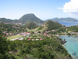
 Marigot village Marigot village | |
 | |
| Coordinates: 15°52′15″N 61°34′37″W / 15.87083°N 61.57694°W / 15.87083; -61.57694 | |
| Country | |
| Overseas department | |
| Canton | les Saintes |
| commune | Terre-de-Haut |
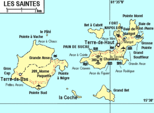
Marigot is a quartier of Terre-de-Haut Island, located in Îles des Saintes archipelago in the Caribbean. It is located in the northeastern part of the island. It is a residential area. The stadium, the middle school, and the Gendarmerie Nationale office are located on this place. In the past it was a big salt pond. The Bay of Marigot is one of the famous beach of the island.
This Guadeloupe location article is a stub. You can help Misplaced Pages by expanding it. |