| Marka | |
|---|---|
 | |
| Coordinates: 17°07′11.8″S 35°13′36.8″E / 17.119944°S 35.226889°E / -17.119944; 35.226889 | |
| Country | |
| Region | Southern Region |
| Time zone | +2 |
| Climate | Cwa |
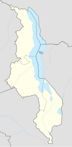
Marka is a town located in Nsanje District in Malawi. It is the southernmost location in the country, serving as a border post for road and rail control between Malawi and Mozambique.
The Mozambican town of Vila Nova de Fronteira is conurbed with Marka. In addition, Marka is part of a large conurbation zone that extends northwards, passing through the city of Nsanje to the city of Bangula.
Transport
The M1 road is the main source of transportation that connects the district to its neighboring district, Chikwawa. Before 2010, transportation to the lower shire district was difficult especially during rainy season.
The town had a railway station on the Sena railway, part of the Malawi Railways. The railway through Marka that connects Nsanje and Blantyre with Beira was severely disrupted by the Mozambique Civil War and remains closed. In the late 1990's, part of the railway was damaged at Chiromo bridge near Bangula. Due to this damage, the train station at Nsanje was closed.
References
- Malemia applauds Malawi govt for K11.1bn Nsanje-Marka road construction. Nyasa Times. 27 July 2019.
- Physical Addresses. Department of Immigration. Republic of Malawi.
- Delays rocks Railway project. The Nation. 19 June 2021.
- ^ "PR lança 1ª pedra para reconstrução da linha férrea Dona Ana/ Vila Nova da Fronteira que liga Moçambique e o Malawi". Rádio Moçambique. 29 May 2021. Retrieved 31 May 2021.
This Malawi location article is a stub. You can help Misplaced Pages by expanding it. |