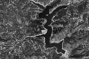
| Lake McCloud | |
|---|---|
 Looking north over McCloud Reservoir Looking north over McCloud Reservoir | |
  | |
| Location | Siskiyou County, California |
| Coordinates | 41°07′52″N 122°04′14″W / 41.13111°N 122.07056°W / 41.13111; -122.07056 |
| Type | Reservoir |
| Primary inflows | McCloud River |
| Primary outflows | McCloud River |
| Basin countries | United States |
| Surface area | 520 acres (210 ha) |
| Water volume | 35,200 acre⋅ft (0.0434 km) |
| Surface elevation | 2,648 ft (807 m) |
| Settlements | McCloud |
| References | |

Lake McCloud is a reservoir on the McCloud River in Northern California. The lake forms behind an earthen dam finished in 1965 (60 years ago) (1965) by the Pacific Gas and Electric Company to control water flows and for generating hydro-electric power. McCloud Dam (National ID # CA00416) is 235 feet (72 m) high, 630 feet (190 m) long at its crest, and impounds a maximum capacity of 35,200 acre-feet (43,400,000 m).
The lake is home to a population of rainbow and brown trout, due in large part to the fact that the lake water temperature stays relatively cold all year.
See also
References
- ^ NPDP database Archived 2011-07-16 at the Wayback Machine accessed 2008-01-10
- ^ U.S. Geological Survey Geographic Names Information System: Lake McCloud
- ^ Shasta-Trinity National Forest site accessed 2008-01-10.
- "Archived copy". Archived from the original on 2016-03-05. Retrieved 2012-09-25.
{{cite web}}: CS1 maint: archived copy as title (link)
External links
- "Lake McCloud". Geographic Names Information System. United States Geological Survey, United States Department of the Interior.
This Shasta County, California-related article is a stub. You can help Misplaced Pages by expanding it. |