| Mgla Мгла | |
|---|---|
| Location of Mgla | |
  | |
| Coordinates: 66°29′52″N 44°26′58″E / 66.49778°N 44.44944°E / 66.49778; 44.44944 | |
| Country | Russia |
| Federal subject | Nenets Autonomous Okrug |
| Population | |
| • Total | 20 |
| Time zone | UTC+3 (MSK |
| Postal code(s) | 166737 |
| Dialing code(s) | +7 81857 |
| OKTMO ID | 11811443111 |
| This article needs additional citations for verification. Please help improve this article by adding citations to reliable sources. Unsourced material may be challenged and removed. Find sources: "Mgla" – news · newspapers · books · scholar · JSTOR (February 2024) (Learn how and when to remove this message) |
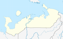
Mgla (Russian: Мгла) is a rural locality (a selo) in Zapolyarny District of Nenets Autonomous Okrug, Russia. Mgla had a population of 20 people as of 2010, a decrease from a population of 33 in 2002.
Geography
Mgla is located in the southern portions of the Kanin Peninsula. The village is on the coast of the White Sea.
This Nenets Autonomous Okrug location article is a stub. You can help Misplaced Pages by expanding it. |
References
- Russian Federal State Statistics Service (2011). Всероссийская перепись населения 2010 года. Том 1 [2010 All-Russian Population Census, vol. 1]. Всероссийская перепись населения 2010 года (in Russian). Federal State Statistics Service.
- "Об исчислении времени". Официальный интернет-портал правовой информации (in Russian). 3 June 2011. Retrieved 19 January 2019.
- Почта России. Информационно-вычислительный центр ОАСУ РПО. (Russian Post). Поиск объектов почтовой связи (Postal Objects Search) (in Russian)