Unincorporated community in Wisconsin, United States
| Miles, Wisconsin | |
|---|---|
| Unincorporated community | |
 | |
  | |
| Coordinates: 45°13′45″N 87°46′45″W / 45.22917°N 87.77917°W / 45.22917; -87.77917 | |
| Country | |
| State | |
| County | Marinette |
| Elevation | 204 m (669 ft) |
| Time zone | UTC-6 (Central (CST)) |
| • Summer (DST) | UTC-5 (CDT) |
| Area code(s) | 715 & 534 |
| GNIS feature ID | 1876857 |
Miles is an unincorporated community located in the town of Porterfield, Marinette County, Wisconsin, United States.
Geography
 1900 railroad map
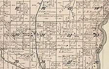
 1912 plat bookLocation of Miles
Miles is located at the intersection of Miles Road and Winesville Road, at an elevation of 689 feet (210 m). It is connected by road to Goll and Wagner (via Old Rail Road, formerly Right of Way Road) to the north, Walsh (via County Highway G) and Porterfield to the south, and Wisconsin Highway 180 to the east.
History

Miles was a stop between Twin Creek and Goll on the Wisconsin & Michigan (W. & M.) Railway line from Bagley Junction to Iron Mountain. The rail line through Miles was discontinued in 1938, when the tracks were torn out and the rolling stock sold off. Miles Road runs through the community east of the old rail line. A post office was established in Miles in 1909, and it operated until 1912. There was also a school in Miles; it operated until 1963, when a new elementary school was built in Porterfield.
References
- U.S. Geological Survey Geographic Names Information System: Miles, Wisconsin
- ^ Porterfield Quadrangle, Wisconsin—Marinette Co., 7.5-Minute Series (Topographic). 1982. Map, 1:24,000. Reston, VA: United States Department of the Interior Geological Survey.
- ^ McLeod, Richard (1968). "History of the Wisconsin and Michigan Railway". The Railway and Locomotive Historical Society Bulletin. 118: 7–20.
- "Seek Permission to Abandon Lines". The Oshkosh Northwestern. April 10, 1937. p. 17. Retrieved August 4, 2019 – via Newspapers.com.

- "Approve Wisconsin and Michigan Ry. Line Abandonment". The Daily Tribune. January 20, 1938. p. 5. Retrieved August 4, 2019 – via Newspapers.com.

- "Wisconsin. Marinette County". Jim Forte Postal History. Retrieved August 2, 2019.
- Standard Atlas of Marinette County Wisconsin Including a Plat Book of the Villages, Cities and Townships of the County. Chicago: Geo. A. Ogle & Co. 1912. p. 70.
- "Sept. 3 Starting Date for Marinette Students". Green Bay Press-Gazette. August 24, 1963. p. 7. Retrieved December 12, 2019 – via Newspapers.com.

- "Marinette School Board Reviews Policy on Age of Kindergartens". Green Bay Press-Gazette. September 11, 1963. p. 16. Retrieved December 12, 2019 – via Newspapers.com.

External links
 Media related to Miles at Wikimedia Commons
| Municipalities and communities of Marinette County, Wisconsin, United States | ||
|---|---|---|
| County seat: Marinette | ||
| Cities |  | |
| Villages | ||
| Towns | ||
| CDPs | ||
| Unincorporated communities | ||
| Footnotes | ‡This populated place also has portions in an adjacent county or counties | |
This article about a location in Marinette County, Wisconsin is a stub. You can help Misplaced Pages by expanding it. |