| Morristown Regional Airport | |||||||||||
|---|---|---|---|---|---|---|---|---|---|---|---|
 The Evelyn Bryan Johnson Terminal at Morristown Regional Airport The Evelyn Bryan Johnson Terminal at Morristown Regional Airport | |||||||||||
| Summary | |||||||||||
| Airport type | Public | ||||||||||
| Owner | City of Morristown | ||||||||||
| Serves | Morristown, Tennessee | ||||||||||
| Elevation AMSL | 1,313 ft / 400 m | ||||||||||
| Coordinates | 36°10′42″N 83°22′38″W / 36.17833°N 83.37722°W / 36.17833; -83.37722 | ||||||||||
| Website | www.mymorristown.com | ||||||||||
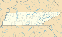
| Map | |||||||||||
  | |||||||||||
| Runways | |||||||||||
| |||||||||||
| Statistics (2018) | |||||||||||
| |||||||||||
| Source: Federal Aviation Administration | |||||||||||
Morristown Regional Airport (IATA: MOR, ICAO: KMOR, FAA LID: MOR) (formerly called Moore–Murrell Airport) is a city-owned public-use airport located four nautical miles (7 km) southwest of the central business district of Morristown, a city in Hamblen County, Tennessee, United States. It was opened in 1953. The manager of the airport was Evelyn Bryan Johnson until her death on May 10, 2012.
This airport is included in the FAA's National Plan of Integrated Airport Systems for 2009–2013, which categorized it as a general aviation facility.
History

An office structure was constructed in 1953 along with a grass strip and maintenance hangar. In 1958, the first paved runway was completed. In 1968, the first professional terminal was dedicated. The original airport terminal was demolished on April 28, 2009. A new, more modern terminal opened in 2010 and was named Eyelyn Bryan Johnson Terminal for its longtime manager, Evelyn Bryan Johnson.
Southern Airways served the airport in the early 1960s with flights to/from Knoxville and Tri-City airports.
1953 - A marker dedicating the field to the memory of the late Rev. Melville M. Murrell, who patented "The American Flying Machine" in 1877. The Rev. Murrell, who secured patent rights to a heavier-than-air machine as early as 1877, was born within sight of the city's new air- th port which is located five miles K west of Morristown at Alpha.
Facilities and aircraft

Morristown Regional Airport covers an area of 160 acres (65 ha) at an elevation of 1,313 feet (400 m) above mean sea level. It has one runway designated 5/23 with an asphalt surface measuring 5,717 by 100 feet (1,743 x 30 m).
For the 12-month period ending October 22, 2009, the airport had 46,000 aircraft operations, an average of 126 per day: 95% general aviation, 4% air taxi, and 1% military. At that time there were 40 aircraft based at this airport: 67.5% single-engine, 25% multi-engine, 5% jet and 2.5% helicopter.
For the 12-month period ending May 25, 2018, the airport had 49,500 aircraft operations, an average of 136 per day: 97% general aviation, 2% air taxi, and 1% military. At that time there were 33 aircraft based at this airport: 60.6% single-engine, 21.2% multi-engine, 12.1% jet, 3% helicopter, and 3% ultralight.
Also on site is Tennessee College of Applied Technology's Aviation Maintenance campus, occupying the terminal building and adjacent hangar.
See also
References
- ^ FAA Airport Form 5010 for MOR PDF. Federal Aviation Administration. Effective 29 July 2010.
- National Plan of Integrated Airport Systems for 2009–2013: Appendix A: Part 5 (PDF, 1.18 MB) Archived 2011-06-06 at the Wayback Machine. Federal Aviation Administration. Updated 15 October 2008.
- "Morristown Regional Airport". MyMorristown.com. Retrieved January 11, 2019.
- Southern Airways timetable 7/1/1963
External links
- Moore–Murrell Airport (MOR) at Tennessee DOT Airport Directory
- Aerial image as of 7 March 1997 from USGS The National Map
- FAA Terminal Procedures for MOR, effective November 28, 2024
- Resources for this airport:
- FAA airport information for MOR
- AirNav airport information for MOR
- ASN accident history for MOR
- FlightAware airport information and live flight tracker
- SkyVector aeronautical chart for MOR