| Mossgiel Tunnel Platform | |
|---|---|
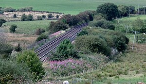
 Mossgiel Tunnel north portal, site of the old station and the mineral siding to Mauchline Colliery. Mossgiel Tunnel north portal, site of the old station and the mineral siding to Mauchline Colliery. | |
| General information | |
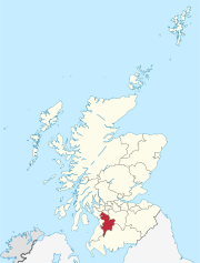
| Location | Near Mauchline, Ayrshire Scotland |
| Coordinates | 55°31′58″N 4°24′32″W / 55.5329°N 4.4089°W / 55.5329; -4.4089 |
| Grid reference | NS2142 |
| Platforms | 1 |
| Other information | |
| Status | Disused |
| History | |
| Pre-grouping | G&SWR |
| Post-grouping | LMS |
| Key dates | |
| After 1896 | Opened |
| After July 1926 | Closed |
Mossgiel Tunnel Platform railway station (NS480292) was not a station constructed for public use. It stood close to the northern portal of the 680 yard Mossgiel Tunnel that runs under the Mossgiel Ridge and Skeoch Hill north of Mauchline, East Ayrshire, Scotland. It may have solely served the transportation requirements of the Glasgow and South-Western Railway and its successor in connection with the carriage of workers involved in the ongoing maintenance and/or the major reconstruction of Mossgiel Tunnel that took place between 1925 and 1927. It was not recorded in the 1896 G&SWR working time table and had closed sometime after July 1926.
Garrochburn Goods Depot once stood near by on the B744 to the north, 6.82 from Kilmarnock and 2.72 from Mauchline. A line to Mauchline Colliery branched off close to the site of the station that opened in 1925 and closed to all traffic in February 1974 after serving as a coal washery for around 5 years after the colliery closed in 1969.
Infrastructure and working
The OS maps of 1895 shows only Garrochburn signal box and signals in the area with a reservoir on the western side of the line and a small building opposite it on the eastern side in the immediate vicinity of the station site. By the 1920s only minor infrastructure was present with the double track main line and one siding running off to a loading dock to the west. Several semaphore signal posts and cross over points were present with runaway points located in the up line about 400yds towards Hurlford from the signal box.
The siding at Garrochburn was also used as a coal siding for coal traffic to or from the nearby Mauchline Colliery. The gradient from Kilmarnock eased at Garrochburn Goods depot before a gentle descent into Mauchline following the passage through Mossgiel or Skeoch Tunnel.
History
The goods depot at Garrochburn was opened by the Glasgow and South-Western Railway in the 1920s and closed on 4 October 1965. Its construction may have been originally have been related to the reconstruction of Mossgiel Tunnel in the mid-1920s. Apart from farm traffic and the possible link with the reconstruction and relining of Mossgiel Tunnel the siding at Garrochburn was also used as a coal siding for coal traffic connected with the siding to Mauchline Colliery.
As stated Mossgiel Tunnel Platform stood close by to the south, and had closed at some point after July 1926 by the LMS when the reconstruction of Mossgiel Tunnel had been completed. The station had only a single platform as the line itself had been singled during the work on the tunnel. A temporary signal box had been established to control the southern access to the tunnel during the relining, etc.
The site today
The siding to Mauchline Colliery has been lifted and much of the track bed has grassed over. No remnants of the station are visible however the likely site is discernable as a wide area on the verge of the line.
See also
| Preceding station | Historical railways | Following station | ||
|---|---|---|---|---|
| Mauchline Line and station open |
Glasgow and South Western Railway Glasgow, Paisley, Kilmarnock and Ayr Railway |
Hurlford Line and station open | ||
References
Notes
| Glasgow, Paisley, Kilmarnock and Ayr Railway |
|---|
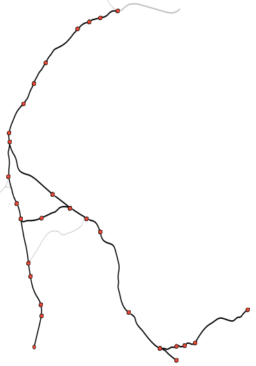
| Diagram of the railway c. 1850 (stations with ✱ are presently open) |
| This diagram: |
- ^ Butt, R.V.J. (1995). The Directory of Railway Stations. Patrick Stevens. p. 164. ISBN 1-85260-508-1.
- ^ McLellan, Dugald (1927). The reconstruction of Mossgiel tunnel. (The Institution of Civil Engineers. Selected engineering papers).
- Glasgow & South-Western Railway (1898). Appendix. Working Time table Instructions. G&SWR. p. 108.
- "Railway Codes". Retrieved 1 August 2017.
- "Mauchline Colliery- Canmore". Retrieved 2 August 2017.
- ^ Wham, Alasdair (2013). Ayrshire's Forgotten Railways. Oakwood Press. p. 91. ISBN 978-0-85361-729-7.
- "Ayrshire 028.04 (includes: Mauchline) Publication date: 1896. Revised: 1895". Retrieved 1 August 2017.
- "Ayrshire 023.16 (includes: Galston; Mauchline) Publication date: 1910. Revised: 1908". Retrieved 1 August 2017.
- "Ayrshire 028.04 (includes: Mauchline) Publication date: 1909. Revised: 1908". Retrieved 1 August 2017.
- Glasgow & South-Western Railway (1898). Appendix. Working Time table Instructions. G&SWR. p. 75.
- "The Ayr Liner Tour 2001" (PDF). Retrieved 2 August 2017.
- "Garrochburn on flikr". Retrieved 1 August 2017.
Sources
- Butt, R. V. J. (October 1995). The Directory of Railway Stations: details every public and private passenger station, halt, platform and stopping place, past and present (1st ed.). Sparkford: Patrick Stephens Ltd. ISBN 978-1-85260-508-7. OCLC 60251199. OL 11956311M.
- Wham, Alasdair (2013). Ayrshire's Forgotten Railways. A Walker's Guide. Cranborne : Oakwood Press. ISBN 978-0-85361-729-7.
- Good's station site on navigable O.S. map

