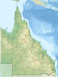
Suburb of Rockhampton Region, Queensland, Australia
| Mount Archer Queensland | |||||||||||||||
|---|---|---|---|---|---|---|---|---|---|---|---|---|---|---|---|
 Mount Archer, 2022 Mount Archer, 2022 | |||||||||||||||
 | |||||||||||||||
| Coordinates | 23°19′48″S 150°34′49″E / 23.33°S 150.5802°E / -23.33; 150.5802 | ||||||||||||||
| Population | 77 (2021 census) | ||||||||||||||
| • Density | 3.263/km (8.45/sq mi) | ||||||||||||||
| Postcode(s) | 4701 | ||||||||||||||
| Area | 23.6 km (9.1 sq mi) | ||||||||||||||
| Time zone | AEST (UTC+10:00) | ||||||||||||||
| Location |
| ||||||||||||||
| LGA(s) | Rockhampton Region | ||||||||||||||
| State electorate(s) | Keppel | ||||||||||||||
| Federal division(s) | Capricornia | ||||||||||||||
| |||||||||||||||
| Mount Archer | |
|---|---|
 | |
| Highest point | |
| Elevation | 604 m (1,982 ft) |
| Coordinates | 23°20′00″S 150°34′58″E / 23.3333°S 150.5828°E / -23.3333; 150.5828 |
| Geography | |
| Location | Queensland, Australia |
| Parent range | Berserker Range |
| Climbing | |
| Easiest route | Road |
Mount Archer is a suburb of Rockhampton and a mountain in the Rockhampton Region, Queensland, Australia. In the 2021 census, Mount Archer had a population of 77 people.
Geography
The mountain is 604 metres (1,982 ft) high, and forms part of the Berserker Range. The Mount Archer National Park surrounds the mountain. Mount Archer is located within the boundaries of the city of Rockhampton. The summit is accessible by a sealed road, Pilbeam Drive, which leads to the upmarket small suburb of Mount Archer, located just below the summit. Lookouts and picnic areas are located on the summit of the mountain, as well as a number of communications towers.
History
The mountain was named in 1859 by surveyor Clarendon Stuart after the Archer brothers who established a pastoral property at Gracemere in 1854.
Demographics
In the 2016 census, Mount Archer had a population of 85 people.
In the 2021 census, Mount Archer had a population of 77 people.
Education
There are no schools in Mount Archer. The nearest government primary school is Frenchville State School in neighbouring Frenchville to the south-west. The nearest government secondary school is North Rockhampton Stat High School, also in neighbouring Frenchville.
Despite the name, Mount Archer State School is not located on the mountain, but in the suburb of Koongal.
See also
References
- ^ Australian Bureau of Statistics (28 June 2022). "Mount Archer (SAL)". 2021 Census QuickStats. Retrieved 28 February 2023.

- ^ "Mount Archer – suburb in Rockhampton Region (entry 48778)". Queensland Place Names. Queensland Government. Retrieved 27 January 2020.
- "Mount Archer – mountain in the Rockhampton REgion (entry 767)". Queensland Place Names. Queensland Government. Retrieved 29 January 2020.
- "Mount Archer (entry 48778)". Queensland Place Names. Queensland Government. Retrieved 8 August 2015.
- Australian Bureau of Statistics (27 June 2017). "Mount Archer (SSC)". 2016 Census QuickStats. Retrieved 20 October 2018.

- "Mount Archer State School". Mount Archer State School. Retrieved 29 January 2020.