| This article needs additional citations for verification. Please help improve this article by adding citations to reliable sources. Unsourced material may be challenged and removed. Find sources: "Mount Hiru" – news · newspapers · books · scholar · JSTOR (January 2021) (Learn how and when to remove this message) |
| Mount Hiru | |
|---|---|
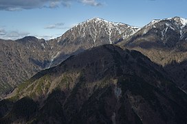
 Mount Hiru from Nabewari-ridge (Dec 2007) Mount Hiru from Nabewari-ridge (Dec 2007) | |
| Highest point | |
| Elevation | 1,675 m (5,495 ft) |
| Coordinates | 35°29′12″N 139°8′20″E / 35.48667°N 139.13889°E / 35.48667; 139.13889 |
| Geography | |
| Location | Kanagawa, Japan |
| Parent range | Tanzawa Mountains |
| Climbing | |
| First ascent | unknown |
Mount Hiru (蛭ヶ岳 Hiru-ga-take) is the tallest mountain of the Tanzawa Mountains with a height of 1,675 metres (5,495 ft).
Gallery
References
- Hodaka (2017-11-26). Japanese 100 Great Mountains Vol.1: Episode 001-005. Lulu Press, Inc. ISBN 978-1-387-39820-1.
This Kanagawa Prefecture location article is a stub. You can help Misplaced Pages by expanding it. |


