| Mount Leyli | |
|---|---|
 Mount Leyli Mount Leyli | |
| Highest point | |
| Elevation | 3,157 m (10,358 ft) |
| Coordinates | 41°09′56″N 43°57′15″E / 41.16556°N 43.95417°E / 41.16556; 43.95417 |
| Geography | |
  | |
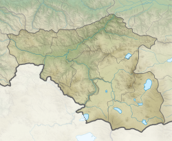
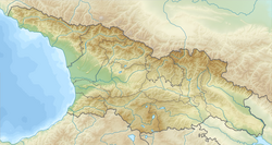
| Location | Samtskhe–Javakheti, Kvemo Kartli, Georgia / Armenia, Shirak Province, Lori Province |
| Countries | Georgia and Armenia |
| Parent range | Javakheti |
| Geology | |
| Rock age | Quaternary |
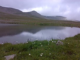
Mount Leyli, also Leili (Georgian: ლეილი) is a 3,157 m (10,358 ft) Mountain lies on the border of Samtskhe–Javakheti, Kvemo Kartli (Georgia) and Shirak Province, Lori Province (Armenia). Leyli is the second highest peak of the Javakheti Range in the Lesser Caucasus Mountains.
See also
Image gallery
References
- Tuniyev,1, 2 B., 3 and B. S., S. B.; Iremashvili, G. N.; de las Heras, B.; Tuniyev, B. S. (2014). "ABOUT TYPE LOCALITY AND FINDS OF DAREVSKY'S VIPER [Pelias darevskii (VEDMEDERJA, ORLOV ET TUNIYEV, 1986), REPTILIA: VIPERINAE] IN GEORGIA". Russian Journal of Herpetology. 21 (4): 281–290.
{{cite journal}}: CS1 maint: multiple names: authors list (link) CS1 maint: numeric names: authors list (link)
This Georgia location article is a stub. You can help Misplaced Pages by expanding it. |

