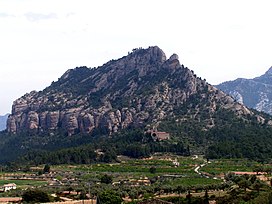
| Muntanya de Santa Bàrbara | |
|---|---|
 | |
| Highest point | |
| Elevation | 751 m (2,464 ft) |
| Coordinates | 40°57′24″N 00°20′17″E / 40.95667°N 0.33806°E / 40.95667; 0.33806 |
| Geography | |
 | |
| Location | Terra Alta, Catalonia |
| Parent range | Ports de Tortosa-Beseit |
| Geology | |
| Mountain type | Karstic |
| Climbing | |
| Easiest route | Hike from Horta de Sant Joan |
Muntanya de Santa Bàrbara is a mountain that is part of the northwestern foothills of the Ports de Tortosa-Beseit, Catalonia, Spain. It has an elevation of 751.3 metres (2,465 ft) above sea level.
The Sant Salvador d'Horta monastery, also known as Convent dels Àngels, is located at the foot of this mountain.
This mountain is one of the Emblematic summits of Catalonia.
See also
References
- "Mapa Topogràfic de Catalunya". Institut Cartogràfic de Catalunya. Retrieved 9 September 2010..
- Llista 100 cims - Institut Cartogràfic i Geològic de Catalunya
External links
This article about a location in Catalonia is a stub. You can help Misplaced Pages by expanding it. |