Name on the Register
Image
Date listed
Location
City or town
Description
1
Allentown Bridge
Allentown Bridge More images
September 30, 1988(#88001617 )
Indian Route 9402 over the Puerco River at milepost 9.135°16′51″N 109°09′16″W / 35.2808°N 109.1544°W / 35.2808; -109.1544 (Allentown Bridge) Houck
2
Alpine Elementary School
Alpine Elementary School More images
April 25, 1997(#97000369 )
11 and 12 County Road 2052, near its junction with U.S. Route 180 33°50′51″N 109°08′27″W / 33.8475°N 109.1408°W / 33.8475; -109.1408 (Alpine Elementary School) Alpine
3
Butterfly Lodge
Butterfly Lodge More images
June 17, 1992(#92000686 )
Forest Rd. 245 east of State Route 373 in the Apache National Forest 34°01′08″N 109°26′57″W / 34.0189°N 109.4492°W / 34.0189; -109.4492 (Butterfly Lodge) Greer
4
Canyon de Chelly National Monument
Canyon de Chelly National Monument More images
August 25, 1970(#70000066 )
Eastern side of Chinle36°08′21″N 109°20′05″W / 36.1392°N 109.3347°W / 36.1392; -109.3347 (Canyon de Chelly National Monument) Chinle
5
Casa Malpais Site
Casa Malpais Site More images
October 15, 1966(#66000936 )
Address restricted34°09′33″N 109°17′24″W / 34.1592°N 109.29°W / 34.1592; -109.29 (Casa Malpais Site) Springerville
6
Chinle Franciscan Mission Historic District
Upload image June 5, 2007(#07000506 )
Indian Service Route 7 across road and southwest of the Chinle Judicial complex and Police Station36°09′06″N 109°33′37″W / 36.1518°N 109.5602°W / 36.1518; -109.5602 (Chinle Franciscan Mission Historic District) Chinle
7
Colter Ranch Historic District
Colter Ranch Historic District More images
July 9, 1993(#93000626 )
Junction of 4th St. and School Bus Rd.34°06′24″N 109°19′11″W / 34.1067°N 109.3197°W / 34.1067; -109.3197 (Colter Ranch Historic District) Eagar
8
Eagar School
Eagar School More images
July 22, 1993(#93000624 )
174 S. Main St.34°06′28″N 109°17′32″W / 34.1079°N 109.2921°W / 34.1079; -109.2921 (Eagar School) Eagar Now the Eagar police station.
9
Eagar Townsite Historic District
Eagar Townsite Historic District More images
July 23, 1993(#93000625 )
Roughly bounded by Central Ave., Main St., 1st Ave. and Eagar St. 2nd Ave, and Harless St., 3rd Ave., and Eagar St.34°06′45″N 109°17′25″W / 34.1125°N 109.2903°W / 34.1125; -109.2903 (Eagar Townsite Historic District) Eagar
10
Flattop Site
Upload image July 12, 1976(#76000214 )
Address restricted Adamana
11
Hubbell Trading Post National Historic Site
Hubbell Trading Post National Historic Site More images
October 15, 1966(#66000167 )
Western side of Ganado35°43′32″N 109°35′36″W / 35.7256°N 109.5933°W / 35.7256; -109.5933 (Hubbell Trading Post National Historic Site) Ganado
12
Isaacson Building
Isaacson Building More images
September 12, 1983(#83002997 )
37 Commercial St.34°30′22″N 109°21′49″W / 34.5061°N 109.3636°W / 34.5061; -109.3636 (Isaacson Building) St. Johns
13
Kin Tiel
Kin Tiel More images
May 22, 1978(#78000540 )
Address restricted Chambers
14
Klagetoh (Leegito) Chapter House
Upload image January 13, 2021(#100006279 )
US 191 , approx. milepost 397 (west side)35°29′58″N 109°31′48″W / 35.4994°N 109.5299°W / 35.4994; -109.5299 (Klagetoh (Leegito) Chapter House) Klagetoh
15
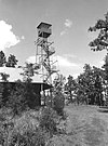
Lake Mountain Lookout Complex
Lake Mountain Lookout Complex More images
January 28, 1988(#87002453 )
Off Vernon McNary Rd.34°09′28″N 109°46′07″W / 34.1578°N 109.7686°W / 34.1578; -109.7686 (Lake Mountain Lookout Complex) McNary
16
Los Burros Ranger Station
Los Burros Ranger Station More images
October 23, 1986(#86002854 )
Forest Rd. 2034°08′27″N 109°45′55″W / 34.1408°N 109.7653°W / 34.1408; -109.7653 (Los Burros Ranger Station) McNary
17
Lower Zuni River Archeological District
Upload image April 29, 1994(#94000398 )
Address restricted St. Johns
18
Lyman Lake Rock Art Site
Upload image August 19, 2003(#97000347 )
Address restricted St. Johns
19
Navajo Nation Council Chamber
Navajo Nation Council Chamber More images
August 18, 2004(#04001155 )
W008-013 Circle Boulevard35°40′58″N 109°02′54″W / 35.6828°N 109.0483°W / 35.6828; -109.0483 (Navajo Nation Council Chamber) Window Rock
20
Newspaper Rock Petroglyphs Archeological District
Newspaper Rock Petroglyphs Archeological District More images
July 12, 1976(#76000185 )
Address restricted34°57′44″N 109°47′57″W / 34.9621°N 109.7991°W / 34.9621; -109.7991 (Newspaper Rock Petroglyphs Archeological District) Adamana
21
Painted Desert Community Complex Historic District
Painted Desert Community Complex Historic District More images
April 15, 2005(#05000284 )
One Park Rd.35°04′06″N 109°46′50″W / 35.0683°N 109.7806°W / 35.0683; -109.7806 (Painted Desert Community Complex Historic District) Petrified Forest National Park
22
Painted Desert Inn
Painted Desert Inn More images
October 10, 1975(#87001421 )
West of Navajo in Petrified Forest National Park , off Interstate 40 35°05′03″N 109°47′06″W / 35.0842°N 109.785°W / 35.0842; -109.785 (Painted Desert Inn) Navajo Designated a National Historic Landmark on May 28, 1987
23
PS Knoll Lookout Complex
PS Knoll Lookout Complex More images
January 28, 1988(#87002451 )
Apache-Sitgreaves National Forest 33°45′16″N 109°23′52″W / 33.7544°N 109.3978°W / 33.7544; -109.3978 (PS Knoll Lookout Complex) Maverick
24
Puerco Ruin and Petroglyphs
Puerco Ruin and Petroglyphs More images
July 12, 1976(#76000208 )
Address restricted34°58′29″N 109°47′39″W / 34.974823°N 109.794089°W / 34.974823; -109.794089 (Puerco Ruin and Petroglyphs) Adamana
25
Querino Canyon Bridge
Querino Canyon Bridge September 30, 1988(#88001623 )
Old U.S. Route 66 over Querino Canyon35°16′49″N 109°15′28″W / 35.280278°N 109.257778°W / 35.280278; -109.257778 (Querino Canyon Bridge) Houck
26
Rattlesnake Point Pueblo
Upload image August 2, 2001(#01000792 )
Lyman Lake State Park 34°21′01″N 109°21′07″W / 34.350319°N 109.351982°W / 34.350319; -109.351982 (Rattlesnake Point Pueblo) St. Johns
27
Sage Memorial Hospital School of Nursing
Upload image January 16, 2009(#09000082 )
Ganado Mission35°42′40″N 109°32′36″W / 35.711111°N 109.543333°W / 35.711111; -109.543333 (Sage Memorial Hospital School of Nursing) Ganado
28
St. Michael's Mission
St. Michael's Mission More images
May 29, 1975(#75000335 )
North of Window Rock off State Route 264 35°38′44″N 109°05′53″W / 35.645556°N 109.098056°W / 35.645556; -109.098056 (St. Michael's Mission) Window Rock
29
Sanders Bridge
Upload image September 30, 1988(#88001618 )
Indian Route 9402 over the Puerco River 35°12′46″N 109°19′47″W / 35.212778°N 109.329722°W / 35.212778; -109.329722 (Sanders Bridge) Sanders
30
Sherwood Ranch Pueblo
Upload image August 17, 2005(#05000887 )
Address restricted Springerville
31
Thirty-Fifth Parallel Route
Thirty-Fifth Parallel Route December 6, 1977(#77000129 )
25 miles east of Holbrook off Interstate 40 35°04′09″N 109°46′14″W / 35.069167°N 109.770556°W / 35.069167; -109.770556 (Thirty-Fifth Parallel Route) Holbrook
32
Twin Buttes Archeological District
Upload image July 12, 1976(#76000952 )
Address restricted Adamana
33
Water Canyon Administrative Site
Upload image June 10, 1993(#93000511 )
Forest Rd. 285 south of Springerville, Apache-Sitgreaves National Forest 34°03′56″N 109°17′34″W / 34.065556°N 109.292778°W / 34.065556; -109.292778 (Water Canyon Administrative Site) Springerville


