Misplaced Pages

National Register of Historic Places listings in Garfield County, Oklahoma

Article snapshot taken from Wikipedia with creative commons attribution-sharealike license. Give it a read and then ask your questions in the chat. We can research this topic together.


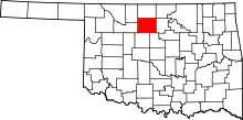
Location of Garfield County in Oklahoma

This is a list of the National Register of Historic Places listings in Garfield County, Oklahoma.

This is intended to be a complete list of the properties and districts on the National Register of Historic Places in Garfield County, Oklahoma, United States. The locations of National Register properties and districts for which the latitude and longitude coordinates are included below, may be seen in a map.

There are 36 properties and districts listed on the National Register in the county.


          This National Park Service list is complete through NPS recent listings posted November 29, 2024.

Map all coordinates using OpenStreetMap

Download coordinates as:

NRHP listings in Oklahoma counties

Current listings

Name on the Register Image Date listed Location City or town Description
1 Babe's Package Store
Babe's Package Store
September 8, 2017
(#100001589)
220 S. 3rd.
36°23′47″N 97°52′29″W / 36.396480°N 97.87476°W / 36.396480; -97.87476 (Babe's Package Store)
Enid
2 Bank of Drummond Upload image October 5, 2023
(#100009399)
402 Main St.
36°18′00″N 98°02′12″W / 36.3000°N 98.0368°W / 36.3000; -98.0368 (Bank of Drummond)
Drummond
3 Bank of Hunter Upload image June 22, 1984
(#84003014)
Cherokee and Main Sts.
36°33′50″N 97°39′40″W / 36.563889°N 97.661111°W / 36.563889; -97.661111 (Bank of Hunter)
Hunter Demolished in 2009 following a roof collapse; last used as a bank in 1991
4 Eugene S. Briggs Auditorium
Eugene S. Briggs Auditorium
September 8, 2017
(#100001590)
2450 E. Maine
36°23′44″N 97°50′35″W / 36.395566°N 97.843119°W / 36.395566; -97.843119 (Eugene S. Briggs Auditorium)
Enid
5 Broadway Tower
Broadway Tower
Broadway Tower
More images
November 14, 1985
(#85002789)
114 E. Broadway St.
36°23′48″N 97°52′38″W / 36.396667°N 97.877222°W / 36.396667; -97.877222 (Broadway Tower)
Enid Enid's tallest building, a 1931 Art Deco structure
6 Carrier Congregational Church
Carrier Congregational Church
June 14, 2016
(#16000370)
204 N. 5th St.
36°28′38″N 98°01′22″W / 36.477101°N 98.022843°W / 36.477101; -98.022843 (Carrier Congregational Church)
Carrier
7 H. H. Champlin House
H. H. Champlin House
More images
January 21, 1993
(#92001833)
612 S. Tyler
36°23′25″N 97°53′36″W / 36.390278°N 97.893333°W / 36.390278; -97.893333 (H. H. Champlin House)
Enid 1939 Tudor Revival house in the Kisner Heights addition
8 Cherokee Terrace Apartments
Cherokee Terrace Apartments
More images
December 18, 2013
(#13000939)
619 E. Maine St.
36°23′42″N 97°52′10″W / 36.394957°N 97.869380°W / 36.394957; -97.869380 (Cherokee Terrace Apartments)
Enid
9 Clay Hall
Clay Hall
Clay Hall
More images
June 20, 2012
(#12000346)
311-325 Lakeview Dr.
36°23′36″N 97°50′50″W / 36.393461°N 97.847169°W / 36.393461; -97.847169 (Clay Hall)
Enid
10 Covington Jail Upload image October 30, 2024
(#100010778)
514 W. Main St.
36°18′21″N 97°35′32″W / 36.3059°N 97.5922°W / 36.3059; -97.5922 (Covington Jail)
Covington
11 T.T. Eason Mansion
T.T. Eason Mansion
T.T. Eason Mansion
March 24, 1987
(#87000417)
1305 W. Broadway
36°23′47″N 97°53′38″W / 36.396389°N 97.893889°W / 36.396389; -97.893889 (T.T. Eason Mansion)
Enid Home to oilman T.T. Eason and located in the Waverley Historic District
12 Enid Armory
Enid Armory
Enid Armory
More images
September 8, 1988
(#88001370)
600 E. Elm
36°24′N 97°52′W / 36.4°N 97.87°W / 36.4; -97.87 (Enid Armory)
Enid
13 Enid Cemetery and Calvary Catholic Cemetery
Enid Cemetery and Calvary Catholic Cemetery
More images
March 21, 1996
(#96000305)
200 block of W. Willow Ave.
36°25′18″N 97°52′47″W / 36.421667°N 97.879722°W / 36.421667; -97.879722 (Enid Cemetery and Calvary Catholic Cemetery)
Enid Burials include H.H. Champlin, the Frantz brothers, James Yancy Callahan, and Houstin James, father of Marquis James
14 Enid Downtown Historic District
Enid Downtown Historic District
More images
December 12, 2007
(#07001265)
Roughly bounded by Maple Ave., 2nd St., Cherokee Ave., and Adams St.
36°23′48″N 97°52′48″W / 36.396639°N 97.879881°W / 36.396639; -97.879881 (Enid Downtown Historic District)
Enid Encompasses the original 1893 town plat and portions of the Jonesville and Weatherly additions; includes the county courthouse, First National Bank, Broadway Tower, and Enid Masonic Temple. A boundary increase was approved on July 15, 2019.
15 Enid High School Observatory
Enid High School Observatory
March 15, 2018
(#100002216)
611 W. Wabash Ave.
36°23′20″N 97°53′09″W / 36.388796°N 97.885936°W / 36.388796; -97.885936 (Enid High School Observatory)
Enid
16 Enid Terminal Grain Elevators Historic District
Enid Terminal Grain Elevators Historic District
More images
April 20, 2009
(#09000239)
Near E. Willow Rd., N. 16th St., N. 10th St., and N. Van Buren St.
36°25′12″N 97°51′17″W / 36.420074°N 97.854735°W / 36.420074; -97.854735 (Enid Terminal Grain Elevators Historic District)
Enid Consists of eight terminal grain elevators constructed between 1925 and 1954
17 Fuksa Portion of the Chisholm Trail Roadbed Upload image September 8, 2015
(#15000578)
Address Restricted
Bison vicinity
18 John and Mary Fuksa Farm Upload image December 8, 2015
(#15000867)
1228 E0580 Rd.
36°10′27″N 97°53′37″W / 36.174198°N 97.893565°W / 36.174198; -97.893565 (John and Mary Fuksa Farm)
Bison
19 Garfield County Courthouse
Garfield County Courthouse
More images
August 23, 1984
(#84003018)
W. Broadway
36°23′49″N 97°52′44″W / 36.396944°N 97.878889°W / 36.396944; -97.878889 (Garfield County Courthouse)
Enid Art Deco courthouse completed in 1936 to replace a building destroyed by fire
20 Harrison School
Harrison School
Harrison School
June 12, 2017
(#100001073)
212 W. Birch Ave.
36°24′34″N 97°52′51″W / 36.409331°N 97.880819°W / 36.409331; -97.880819 (Harrison School)
Enid
21 R. E. Hoy No. 1 Oil Well Upload image September 26, 1986
(#86002357)
Off U.S. Route 64
36°21′24″N 97°34′22″W / 36.356667°N 97.572778°W / 36.356667; -97.572778 (R. E. Hoy No. 1 Oil Well)
Covington First oil well drilled in Oklahoma under a geologist's instruction and the beginning of the Covington-Garber field
22 Jackson School
Jackson School
Jackson School
July 19, 1989
(#89000848)
415 E. Illinois
36°23′07″N 97°49′42″W / 36.385278°N 97.828333°W / 36.385278; -97.828333 (Jackson School)
Enid One of three Mission/Spanish Colonial Revival structures in Enid; operated as an elementary school from 1936 to 1969.
23 H.L. Kaufman House Upload image December 12, 1985
(#85003339)
1708 W. Maine
36°23′44″N 97°53′56″W / 36.395556°N 97.898889°W / 36.395556; -97.898889 (H.L. Kaufman House)
Enid Built for Herbert Lyons Kaufman, a Jewish Enid merchant who owned the downtown Kaufman Style Shop; demolished in 2005
24 Kenwood Historic District
Kenwood Historic District
December 6, 2004
(#04001328)
Bounded by Oak St., Maple, Washington, and Madison
36°24′03″N 97°53′00″W / 36.400833°N 97.883333°W / 36.400833; -97.883333 (Kenwood Historic District)
Enid Encompasses 160 acres (0.65 km) of housing created between 1895 and 1915; majority of houses are American Foursquares
25 Kimmell Barn
Kimmell Barn
Kimmell Barn
January 30, 1984
(#84003021)
Northeast of Covington
36°21′43″N 97°32′21″W / 36.361944°N 97.539167°W / 36.361944; -97.539167 (Kimmell Barn)
Covington Sandstone bank barn constructed in 1906 in a German style
26 Robert R. and Minnie L. Kisner House
Robert R. and Minnie L. Kisner House
December 8, 2015
(#15000870)
1111 Wynona Ave.
36°23′19″N 97°53′33″W / 36.388706°N 97.892404°W / 36.388706; -97.892404 (Robert R. and Minnie L. Kisner House)
Enid
27 Lamerton House
Lamerton House
Lamerton House
June 20, 1997
(#97000613)
1420 W. Indian Dr.
36°23′12″N 97°53′41″W / 36.386667°N 97.894722°W / 36.386667; -97.894722 (Lamerton House)
Enid Tudor Revival house designed in 1928 by John Duncan Forsyth of Tulsa
28 Liberty Federal Savings and Loan Association Building Upload image December 7, 2021
(#100007233)
401 West Broadway Ave.
36°23′48″N 97°52′59″W / 36.3966°N 97.8831°W / 36.3966; -97.8831 (Liberty Federal Savings and Loan Association Building)
Enid
29 Marshall Hall
Marshall Hall
Marshall Hall
More images
December 8, 2015
(#15000868)
100 S. University Ave.
36°23′47″N 97°53′40″W / 36.396389°N 97.894444°W / 36.396389; -97.894444 (Marshall Hall)
Enid On the campus of Northern Oklahoma College
30 McCristy-Knox Mansion
McCristy-Knox Mansion
March 24, 1987
(#87000418)
1323 W. Broadway
36°23′47″N 97°53′40″W / 36.396389°N 97.894444°W / 36.396389; -97.894444 (McCristy-Knox Mansion)
Enid Built in 1909 and home to mill owner Joseph McChristy, oilman Charles Knox, and Michael Hedges; located within the Waverley Historic District
31 Public Library of Enid and Garfield County
Public Library of Enid and Garfield County
More images
December 8, 2015
(#15000869)
120 W. Maine St.
36°23′45″N 97°52′45″W / 36.3958°N 97.8791°W / 36.3958; -97.8791 (Public Library of Enid and Garfield County)
Enid
32 Rock Island Depot
Rock Island Depot
Rock Island Depot
July 18, 1979
(#79003639)
200 Owen K. Garriott Boulevard
36°23′25″N 97°52′37″W / 36.390278°N 97.876944°W / 36.390278; -97.876944 (Rock Island Depot)
Enid Built in 1928, 3 miles (4.8 km) south of the original location; dispute over depot location prompted the Enid-Pond Creek Railroad War
33 Santa Fe Freight Depot
Santa Fe Freight Depot
December 8, 2015
(#15000871)
702 N. Washington Ave.
36°24′14″N 97°52′55″W / 36.403861°N 97.881957°W / 36.403861; -97.881957 (Santa Fe Freight Depot)
Enid Houses the Railroad Museum of Oklahoma.
34 Security National Bank
Security National Bank
September 8, 2017
(#100001591)
201 W. Broadway
36°23′48″N 97°52′49″W / 36.396646°N 97.880329°W / 36.396646; -97.880329 (Security National Bank)
Enid
35 Waverley Historic District
Waverley Historic District
More images
December 6, 2006
(#06001110)
Roughly bounded by W. Broadway Ave., N. and S. Tyler Sts., S. Harrison St., W. Oklahoma St., and N. and S. Buchanan Sts.
36°23′48″N 97°53′44″W / 36.396667°N 97.895556°W / 36.396667; -97.895556 (Waverley Historic District)
Enid Platted between 1902 and 1907; consists of 275 buildings, primarily residential, including the T.T. Eason Mansion and the McChristy-Knox Mansion
36 Booker T. Washington School Upload image August 23, 2024
(#100010777)
801 Pastor Alfred Baldwin Jr. Way
36°23′20″N 97°52′13″W / 36.3889°N 97.8704°W / 36.3889; -97.8704 (Booker T. Washington School)
Enid

See also

References

  1. The latitude and longitude information provided in this table was derived originally from the National Register Information System, which has been found to be fairly accurate for about 99% of listings. Some locations in this table may have been corrected to current GPS standards.
  2. National Park Service, United States Department of the Interior, "National Register of Historic Places: Weekly List Actions", retrieved November 29, 2024.
  3. Numbers represent an alphabetical ordering by significant words. Various colorings, defined here, differentiate National Historic Landmarks and historic districts from other NRHP buildings, structures, sites or objects.
  4. "National Register Information System". National Register of Historic Places. National Park Service. March 13, 2009.
  5. The eight-digit number below each date is the number assigned to each location in the National Register Information System database, which can be viewed by clicking the number.
  6. Rains, Cass, "Fearing a collapse, century-old Hunter landmark demolished," Enid News & Eagle, May 22, 2009.
  7. National Register of Historic Places Inventory/Nomination for the Broadway Tower, #85002789 (PDF), National Park Service, 1985, archived from the original (PDF) on 2010-06-24
  8. National Register of Historic Places Inventory/Nomination for the H.H. Champlin House, #92001833 (PDF), National Park Service, 1985, archived from the original (PDF) on 2010-06-25
  9. National Register of Historic Places Inventory/Nomination for Eason Mansion, #87000417 (PDF), National Park Service, 1987, archived from the original (PDF) on 2010-06-24, retrieved 2010-04-27
  10. National Register of Historic Places Inventory/Nomination for Enid Armory, #88001370 (PDF), National Park Service, 1988, archived from the original (PDF) on 2010-06-25
  11. Barron, Robert, City, school to swap properties", Enid News & Eagle, November 3, 2010
  12. National Register of Historic Places Inventory/Nomination for Enid Cemetery and Calvary Catholic Cemetery, #96000305 (PDF), National Park Service, 1984, archived from the original (PDF) on 2010-06-25
  13. National Register of Historic Places Inventory/Nomination for Enid Downtown Historic District, #07001265 (PDF), National Park Service, 2007, archived from the original (PDF) on 2010-06-26
  14. National Register of Historic Places Inventory/Nomination for Enid Terminal Grain Elevators Historic District, #09000239 (PDF), National Park Service, 2009, archived from the original (PDF) on 2014-07-18
  15. National Register of Historic Places Inventory/Nomination for Garfield County Courthouse, #84003018 (PDF), National Park Service, 1984, archived from the original (PDF) on 2010-06-26
  16. Carney, G.O., ed. Energy Northwest Oklahoma 1910 to 1930, 1986
  17. National Register of Historic Places Inventory/Nomination for Jackson School, #89000848 (PDF), National Park Service, 1989, archived from the original (PDF) on 2010-06-24
  18. National Register of Historic Places Inventory/Nomination for H.L. Kaufman House, #85003339 (PDF), National Park Service, 1985, archived from the original (PDF) on 2012-03-05
  19. "Archived copy". Archived from the original on 2011-07-10. Retrieved 2010-04-27.{{cite web}}: CS1 maint: archived copy as title (link)
  20. National Register of Historic Places Inventory/Nomination for Kenwood Historic District, #04001328 (PDF), National Park Service, 2004, archived from the original (PDF) on 2010-06-24
  21. "Oklahoma National Register Properties: Kimmell Barn". Archived from the original on 2010-06-21. Retrieved 2010-08-15.
  22. National Register of Historic Places Inventory/Nomination for Lamerton House, #97000613 (PDF), National Park Service, 1997, archived from the original (PDF) on 2010-06-24
  23. National Register of Historic Places Inventory/Nomination for McCristy Knox Mansion, #87000418 (PDF), National Park Service, 1987, archived from the original (PDF) on 2010-06-25, retrieved 2010-04-27
  24. National Register of Historic Places Inventory/Nomination for Rock Island Depot, #79003639 (PDF), National Park Service, 1989, archived from the original (PDF) on 2010-06-25
  25. National Register of Historic Places Inventory/Nomination for Waverley Historic District, #06001110 (PDF), National Park Service, 2006
U.S. National Register of Historic Places
Topics
Lists by state
Lists by insular areas
Lists by associated state
Other areas
Related
National Register of Historic Places in Garfield County, Oklahoma
Covington Garfield County map
Enid
Hunter
See also: National Register of Historic Places listings in Garfield County, Oklahoma and List of National Historic Landmarks in Oklahoma
Municipalities and communities of Garfield County, Oklahoma, United States
County seat: Enid
Cities
Map of Oklahoma highlighting Garfield County
Towns
CDP
Unincorporated
communities
Categories: