Name on the Register
Image
Date listed
Location
City or town
Description
1
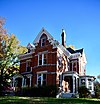
Edwin and Nora Payne Bedford House
Edwin and Nora Payne Bedford House January 23, 1998(#97001666 )
308 S. Main St.39°08′39″N 92°40′51″W / 39.144167°N 92.680791°W / 39.144167; -92.680791 (Edwin and Nora Payne Bedford House) Fayette
2
Boonslick State Park
Boonslick State Park December 30, 1969(#69000104 )
1 mile (1.6 km) north of Boonesboro on MO 87 , 2 miles (3.2 km) southwest on MO 187 39°05′01″N 92°52′44″W / 39.083611°N 92.878889°W / 39.083611; -92.878889 (Boonslick State Park) Boonesboro
3
Campbell Chapel African Methodist Episcopal Church
Campbell Chapel African Methodist Episcopal Church November 13, 1997(#97001427 )
602 Commerce St.39°13′36″N 92°50′29″W / 39.226667°N 92.841389°W / 39.226667; -92.841389 (Campbell Chapel African Methodist Episcopal Church) Glasgow
4
Cedar Grove
Cedar Grove More images
July 19, 1982(#82003140 )
West of Franklin39°00′35″N 92°47′57″W / 39.009722°N 92.799167°W / 39.009722; -92.799167 (Cedar Grove) Franklin
5
Central Methodist College Campus Historic District
Central Methodist College Campus Historic District More images
September 15, 1980(#80002357 )
Roughly bounded by Mulberry, Elm, Church and MO 539°09′01″N 92°41′07″W / 39.150380°N 92.685380°W / 39.150380; -92.685380 (Central Methodist College Campus Historic District) Fayette
6
Coleman Hall
Coleman Hall June 11, 1986(#86001326 )
502 N. Linn39°08′55″N 92°41′10″W / 39.148611°N 92.686111°W / 39.148611; -92.686111 (Coleman Hall) Fayette
7
Fayette City Park Swimming Pool
Fayette City Park Swimming Pool April 15, 1999(#99000457 )
Memorial Park39°09′07″N 92°41′42″W / 39.151944°N 92.695°W / 39.151944; -92.695 (Fayette City Park Swimming Pool) Fayette
8
Fayette Courthouse Square Historic District
Fayette Courthouse Square Historic District More images
February 5, 1998(#98000069 )
Roughly along S. Main and N. Main, W. Morrison, E. Morrison, N. Church, and W. Davis Sts.39°08′45″N 92°40′57″W / 39.145833°N 92.6825°W / 39.145833; -92.6825 (Fayette Courthouse Square Historic District) Fayette
9
Fayette Residential Historic District
Upload image September 3, 2009(#09000681 )
Roughly bounded by Church Street, West Morrison Street and Cleveland Avenue39°08′35″N 92°41′08″W / 39.143056°N 92.685556°W / 39.143056; -92.685556 (Fayette Residential Historic District) Fayette
10
Finks-Harvey Plantation
Upload image December 11, 1978(#78001649 )
West of Roanoke39°19′20″N 92°45′11″W / 39.322222°N 92.753056°W / 39.322222; -92.753056 (Finks-Harvey Plantation) Roanoke
11
Glasgow Commercial Historic District
Glasgow Commercial Historic District January 16, 1992(#91001915 )
501-623 First St., 100-195 Market St., 603 Second St.39°13′35″N 92°50′48″W / 39.226389°N 92.846667°W / 39.226389; -92.846667 (Glasgow Commercial Historic District) Glasgow
12
Glasgow Presbyterian Church
Glasgow Presbyterian Church September 9, 1982(#82003141 )
Commerce and 4th Sts.39°13′36″N 92°50′36″W / 39.226667°N 92.843333°W / 39.226667; -92.843333 (Glasgow Presbyterian Church) Glasgow
13
Glasgow Public Library
Glasgow Public Library May 21, 1969(#69000106 )
NW corner Market and 4th Sts.39°13′34″N 92°50′36″W / 39.226111°N 92.843333°W / 39.226111; -92.843333 (Glasgow Public Library) Glasgow
14
Greenwood
Greenwood March 29, 1983(#83000994 )
MO 539°03′49″N 92°45′04″W / 39.063611°N 92.751111°W / 39.063611; -92.751111 (Greenwood) Fayette
15
Harris-Chilton-Ruble House
Harris-Chilton-Ruble House September 4, 1980(#80002359 )
108 N. Missouri Ave.39°01′12″N 92°44′28″W / 39.02°N 92.741111°W / 39.02; -92.741111 (Harris-Chilton-Ruble House) New Franklin
16
Thomas Hickman House
Upload image July 19, 2006(#06000627 )
10 Research Center Rd.39°01′22″N 92°45′37″W / 39.022778°N 92.760278°W / 39.022778; -92.760278 (Thomas Hickman House) New Franklin
17
Inglewood
Upload image June 21, 1990(#90000981 )
701 Randolph St.39°13′48″N 92°50′18″W / 39.23°N 92.838333°W / 39.23; -92.838333 (Inglewood) Glasgow
18
Prior Jackson Homeplace
Upload image March 10, 1980(#80002358 )
South of Fayette on MO DD39°08′03″N 92°41′20″W / 39.134167°N 92.688889°W / 39.134167; -92.688889 (Prior Jackson Homeplace) Fayette
19
Alfred W. Morrison House
Upload image April 16, 1969(#69000105 )
1 mile (1.6 km) southwest of Fayette on MO 5 39°08′03″N 92°41′36″W / 39.134167°N 92.693333°W / 39.134167; -92.693333 (Alfred W. Morrison House) Fayette
20
New Franklin Commercial Historic District
New Franklin Commercial Historic District January 23, 2013(#12001207 )
106-136 & 101-113 E. Broadway39°01′02″N 92°44′12″W / 39.0173°N 92.736651°W / 39.0173; -92.736651 (New Franklin Commercial Historic District) New Franklin
21
Oakwood
Oakwood September 23, 1982(#82003138 )
1 Leonard Ave.39°08′51″N 92°40′34″W / 39.1475°N 92.676111°W / 39.1475; -92.676111 (Oakwood) Fayette
22
Rivercene
Upload image February 16, 1973(#73001039 )
R.F.D. 138°59′08″N 92°44′30″W / 38.985556°N 92.741667°W / 38.985556; -92.741667 (Rivercene) New Franklin
23
St. Mary's Episcopal Church
St. Mary's Episcopal Church More images
September 9, 1982(#82003139 )
104 W. Davis St.39°08′46″N 92°41′06″W / 39.146111°N 92.685°W / 39.146111; -92.685 (St. Mary's Episcopal Church) Fayette
24
South Main Street Historic District
South Main Street Historic District February 5, 1999(#99000083 )
200, 202, 204, and 208-312 South Main St.39°08′37″N 92°40′50″W / 39.143611°N 92.680556°W / 39.143611; -92.680556 (South Main Street Historic District) Fayette
25
Dr. Uriel S. Wright Office
Dr. Uriel S. Wright Office December 22, 1987(#87001727 )
120 Church St.39°08′49″N 92°41′01″W / 39.146944°N 92.683611°W / 39.146944; -92.683611 (Dr. Uriel S. Wright Office) Fayette


