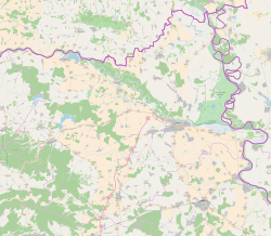
| Nemetin | |
|---|---|
| Village (Selo) | |
  | |
| Coordinates: 45°32′23″N 18°46′26″E / 45.53972°N 18.77389°E / 45.53972; 18.77389 | |
| Country | |
| County | |
| City | Osijek |
| Area | |
| • Total | 7.0 km (2.7 sq mi) |
| Population | |
| • Total | 77 |
| • Density | 11/km (28/sq mi) |
| Time zone | UTC+1 (CET) |
| • Summer (DST) | UTC+2 (CEST) |
| Postal code | 31000 Osijek |
| Area code | 031 |
| Vehicle registration | OS |
Nemetin (Hungarian: Drávanémeti) is a village in eastern Slavonia, Croatia, located near Osijek. It has a population of 139 (census 2011). It is administratively located in the City of Osijek.
History
The village was the site of the largest prisoner exchange in the Croatian War of Independence when on August 14, 1992, 662 Croatian soldiers and civilians were returned from Yugoslavian custody. Most of the prisoners had been incarcerated in the Sremska Mitrovica camp in Serbia. A group of citizens of Bosnia and Herzegovina were also freed as part of the transfer, including Sulejman Tihić. A memorial to the event was unveiled on its fifteenth anniversary.
During the war the area was mined. In 2006, a business zone in the area was officially demined.
References
- Register of spatial units of the State Geodetic Administration of the Republic of Croatia. Wikidata Q119585703.
- "Population by Age and Sex, by Settlements" (xlsx). Census of Population, Households and Dwellings in 2021. Zagreb: Croatian Bureau of Statistics. 2022.
- "Population by Age and Sex, by Settlements, 2011 Census: Nemetin". Census of Population, Households and Dwellings 2011. Zagreb: Croatian Bureau of Statistics. December 2012.
- ^ 15. obljetnica razmjene ratnih zarobljenika u Nemetinu, Jutarnji List
- ^ Spomen-obilježje u Nemetinu, Croatian Radiotelevision
- "Razminirana poslovna zona Nemetin". Poslovni dnevnik (in Croatian).
| Osijek | ||
|---|---|---|
| History |  | |
| Districts | ||
| Suburbs | ||
| Buildings and landmarks | ||
| Churches |
| |
| Culture | ||
| Galleries and museums | ||
| Education | ||
| Sports venues | ||
| Transport | ||
| Festivals | ||
| Neighboring municipalities | ||
45°32′N 18°46′E / 45.533°N 18.767°E / 45.533; 18.767
This Osijek-Baranja County geography article is a stub. You can help Misplaced Pages by expanding it. |