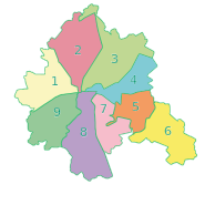
| Nemyshlianskyi District Немишлянський район | |
|---|---|
| Urban district in Kharkiv | |
| Country | |
| Oblast | Kharkiv Oblast |
| Government | |
| • Head of Administration | Tetyana Myronenko (Kernes Bloc — Successful Kharkiv) |
| Area | |
| • Total | 22.3 km (8.6 sq mi) |
| Population | |
| • Total | 144,200 |
| Time zone | UTC+2 (EET) |
| • Summer (DST) | UTC+3 (EEST) |

|
Nemyshlianskyi District (Ukrainian: Немишлянський район) is an urban district of the city of Kharkiv, Ukraine, named after a neighborhood and river in the city Nemyshlia.
History

The district was formed by the Decree of the Presidium of the Supreme Soviet of the Ukrainian SSR on April 12, from part of the territories of the Moskovskyi, Ordzhonikidzevskyi, and Kominternivskyi districts of the city and was named after the military leader, commander of the Southern Front of the Red Army, whose headquarters were in Kharkov, Mikhail Frunze. In 2016 it was renamed to its current name to comply with decommunization laws.
During the Russian Invasion of Ukraine, three drones hit the petrol station in the district following a Russian attack on Kharkiv.
Industry and trade

Well-known industrial giants work on the territory of the district: Turboatom, Zavod Pivdenkabel, Khladoprom, JSC Budinvest.
Education and science
There are 13 children's pre-school institutions, 19 schools in the district, world-famous scientific and technical developments and technologies of scientific institutions of the district: IPMash of the National Academy of Sciences of Ukraine, Institute of Plant Breeding named after V. Ya. Yuryeva, CJSC "ENAS", JSC "Potential" and others.
Sport

There are 2 sports schools, the largest Sports Palace in Ukraine, and two swimming pools in the area.
Health care
On the territory of the district work:
- city polyclinics No. 3 and 5;
- children's city polyclinic No. 15;
- dental polyclinic No. 3;
- two women's consultations;
- two outpatient clinics of family medicine.
On the territory of the district there is a unique institution of its kind in Ukraine - a medical complex.
Places

- Nemyshlia
- Horbany
- Pavlenky
- Fedortsi
- Novo-Zakhidnyi
- Saltivka: Druhe Saltivske selyshche, Tretye Saltivske selyshche,
- micro-districts: 624, 625, 626, 627
References
- (in Russian) Kharkiv renamed 5 metro stations and four districts, RBC Ukraine (18 May 2016)
(in Ukrainian) Another 48 streets and 5 districts "decommunized" in Kharkiv, Ukrayinska Pravda (3 February 2015)
(in Russian) Three districts renamed in Kharkiv, SQ (3 February 2015)
(in Ukrainian) In Kharkiv, five metro stations and fifty streets have been communicated, Korrespondent.net, 18 May 2016) - "Russian drones kill 7 in Ukrainian city of Kharkiv". NBC News. 2024-02-10. Retrieved 2024-02-11.
| Subdivisions of Kharkiv | |
|---|---|
| Districts | |
| City neighborhoods |
|
49°57′00″N 36°19′01″E / 49.950°N 36.317°E / 49.950; 36.317
This article about a location in Kharkiv Oblast is a stub. You can help Misplaced Pages by expanding it. |