Town in Colorado, United States
| New Castle, Colorado | |
|---|---|
| Town | |
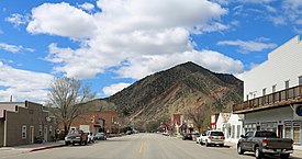
 Main Street, looking towards the Grand Hogback Main Street, looking towards the Grand Hogback | |
| Motto: "Authentically Colorado" | |
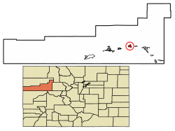
 Location of New Castle in Garfield County, Colorado. Location of New Castle in Garfield County, Colorado. | |
| Coordinates: 39°34′20″N 107°32′6″W / 39.57222°N 107.53500°W / 39.57222; -107.53500 | |
| Country | |
| State | |
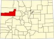
| County | Garfield County |
| Incorporated (town) | March 27, 1890 |
| Government | |
| • Type | Home rule municipality |
| Area | |
| • Total | 2.61 sq mi (6.75 km) |
| • Land | 2.52 sq mi (6.52 km) |
| • Water | 0.09 sq mi (0.23 km) |
| Elevation | 5,811 ft (1,771 m) |
| Population | |
| • Total | 4,923 |
| • Density | 1,900/sq mi (730/km) |
| Time zone | UTC-7 (Mountain (MST)) |
| • Summer (DST) | UTC-6 (MDT) |
| ZIP code | 81647 |
| Area code | 970 |
| FIPS code | 08-53395 |
| GNIS feature ID | 2413042 |
| Website | www |
The Town of New Castle is a home rule municipality in Garfield County, Colorado, United States. The population was 4,923 at the 2020 census.
History
When New Castle was incorporated in 1888, its economy was largely based on mining coal that was needed by the silver-mining industry to fire silver smelters. On February 18, 1896, a methane explosion in the Vulcan Mine killed 49 men and started a coal fire that was still burning as of 2020. The Vulcan reopened and suffered additional explosions on December 12, 1913 (killing 37) and November 4, 1918 (killing 3).
There are at least 25 coal fires burning near the town. They are normally confined underground.
From 2000 - 2014 the population grew 129%, much higher than the average growth in Colorado over the same period (20.8%).
Geography
New Castle is located on the north side of the Colorado River, just east of where the river cuts through the Grand Hogback. Interstate 70 passes by the town following the river, with access from Exit 105. I-70 leads east 12 miles (19 km) to Glenwood Springs, the county seat, east 169 miles (272 km) to Denver, and west 74 miles (119 km) to Grand Junction. U.S. Route 6 is Main Street in New Castle and forms a parallel route to I-70 for local traffic. US-6 joins I-70 5 miles (8 km) to the east at Chacra and 17 miles (27 km) to the west at a point west of Rifle.
According to the United States Census Bureau, the town has a total area of 2.7 square miles (7.0 km), of which 2.7 square miles (6.9 km) is land and 0.04 square miles (0.1 km), or 1.21%, is water.
Demographics
| Census | Pop. | Note | %± |
|---|---|---|---|
| 1890 | 311 | — | |
| 1900 | 431 | 38.6% | |
| 1910 | 493 | 14.4% | |
| 1920 | 447 | −9.3% | |
| 1930 | 470 | 5.1% | |
| 1940 | 484 | 3.0% | |
| 1950 | 483 | −0.2% | |
| 1960 | 447 | −7.5% | |
| 1970 | 499 | 11.6% | |
| 1980 | 563 | 12.8% | |
| 1990 | 679 | 20.6% | |
| 2000 | 1,984 | 192.2% | |
| 2010 | 4,518 | 127.7% | |
| 2020 | 4,923 | 9.0% | |
| U.S. Decennial Census | |||
Education
New Castle is within Garfield Re-2 School District. The town is home to two elementary schools, a middle school, and a high school:
- Elk Creek Elementary School
- Kathryn Senor Elementary School
- Riverside Middle School
- Coal Ridge High School
See also
References
- ^ "Active Colorado Municipalities". State of Colorado, Department of Local Affairs. Archived from the original on December 12, 2009. Retrieved September 1, 2007.
- "Colorado Municipal Incorporations". State of Colorado, Department of Personnel & Administration, Colorado State Archives. December 1, 2004. Retrieved September 2, 2007.
- "2019 U.S. Gazetteer Files". United States Census Bureau. Retrieved July 1, 2020.
- ^ U.S. Geological Survey Geographic Names Information System: New Castle, Colorado
- ^ United States Census Bureau. "New Castle town; Colorado". Retrieved April 24, 2023.
- "ZIP Code Lookup". United States Postal Service. Archived from the original (JavaScript/HTML) on January 1, 2008. Retrieved November 26, 2007.
- "Vulcan Mine Explosions". February 8, 2021.
- "Vulcan Mine".
- http://www.usa.com/new-castle-co.htm
- "Geographic Identifiers: 2010 Demographic Profile Data (G001): New Castle town, Colorado". American Factfinder. U.S. Census Bureau. Retrieved November 16, 2016.
- "About Garfield Re-2". Garfield Re-2 School District. Retrieved May 15, 2020.
External links
| Municipalities and communities of Garfield County, Colorado, United States | ||
|---|---|---|
| County seat: Glenwood Springs | ||
| Cities |  | |
| Towns | ||
| CDPs | ||
| Unincorporated communities | ||
| Ghost town | ||