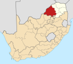
Place in Limpopo, South Africa
| Northam | |
|---|---|
  | |
| Coordinates: 24°57′00″S 27°15′58″E / 24.950°S 27.266°E / -24.950; 27.266 | |
| Country | South Africa |
| Province | Limpopo |
| District | Waterberg |
| Municipality | Thabazimbi |
| Government | |
| • Councillor | judy mogale (ANC) |
| Area | |
| • Total | 3.54 km (1.37 sq mi) |
| Population | |
| • Total | 2,381 |
| • Density | 670/km (1,700/sq mi) |
| Racial makeup (2011) | |
| • Black African | 83.5% |
| • Coloured | 2.1% |
| • Indian/Asian | 1.1% |
| • White | 12.6% |
| • Other | 0.8% |
| First languages (2011) | |
| • Tswana | 42.2% |
| • Afrikaans | 14.7% |
| • English | 8.1% |
| • Northern Sotho | 6.8% |
| • Other | 28.2% |
| Time zone | UTC+2 (SAST) |
| Postal code (street) | 0360 |
| PO box | 0360 |
| Area code | 014 |
Northam is a town in the Waterberg District Municipality in the Limpopo province of South Africa. It is approximately 54 km south of Thabazimbi on the R510 road.
History
The town was proclaimed in 1946 by E.H.J. Fulls on the farm Leeukoppie, which belonged to H. Herd, and was originally one of a number of farms allocated to British veterans of the Anglo-Boer war.
Economy
There are chrome and platinum mines in the area surrounding the town.
Culture and contemporary life
Northam is also home to the South African music festival Oppikoppi., which attracted hundreds of artists and thousands of fans every year in August.
References
- ^ "Sub Place Northam". Census 2011.
- "Travel distances". saexplorer. Retrieved 22 July 2015.
- ^ "Northham". SA-Venues. Retrieved 12 January 2014.
- Erasmus, B.P.J. (2014). On Route in South Africa: Explore South Africa region by region. Jonathan Ball Publishers. p. 401. ISBN 9781920289805.
| Municipalities and communities of Waterberg District Municipality, Limpopo | ||
|---|---|---|
| District seat: Nylstroom (Modimolle) | ||
| Thabazimbi |  | |
| Lephalale |
| |
| Modimolle–Mookgophong |
| |
| Bela-Bela |
| |
| Mogalakwena |
| |
This Limpopo location article is a stub. You can help Misplaced Pages by expanding it. |