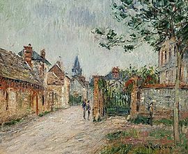
Commune in Normandy, France
| Le Vaudreuil | |
|---|---|
| Commune | |
 A panorama of Saint-Cyr-du-Vaudreuil A panorama of Saint-Cyr-du-Vaudreuil | |
 Coat of arms Coat of arms | |
| Location of Le Vaudreuil | |
  | |
| Coordinates: 49°15′25″N 1°12′24″E / 49.2569°N 1.2067°E / 49.2569; 1.2067 | |
| Country | France |
| Region | Normandy |
| Department | Eure |
| Arrondissement | Les Andelys |
| Canton | Val-de-Reuil |
| Intercommunality | CA Seine-Eure |
| Government | |
| • Mayor (2020–2026) | Bernard Leroy |
| Area | 14.22 km (5.49 sq mi) |
| Population | 3,632 |
| • Density | 260/km (660/sq mi) |
| Time zone | UTC+01:00 (CET) |
| • Summer (DST) | UTC+02:00 (CEST) |
| INSEE/Postal code | 27528 /27100 |
| Elevation | 8–127 m (26–417 ft) (avg. 13 m or 43 ft) |
| French Land Register data, which excludes lakes, ponds, glaciers > 1 km (0.386 sq mi or 247 acres) and river estuaries. | |
Le Vaudreuil (French pronunciation: [lə vodʁœj]) is a commune in the Eure department in Normandy in northern France.
On 15 April 1969 the commune of Notre-Dame-du-Vaudreuil was joined with that of Saint-Cyr-du-Vaudreuil to form the present Le Vaudreuil.
A bronze statue of the deputy Edgar Raoul-Duval was erected in 1890 in Notre-Dame-du-Vaudreuil.
Population
| Year | Pop. | ±% p.a. |
|---|---|---|
| 1968 | 1,478 | — |
| 1975 | 1,891 | +3.58% |
| 1982 | 2,877 | +6.18% |
| 1990 | 3,079 | +0.85% |
| 1999 | 3,438 | +1.23% |
| 2007 | 3,508 | +0.25% |
| 2012 | 3,652 | +0.81% |
| 2017 | 3,722 | +0.38% |
| Source: INSEE | ||
International relations
See also: List of twin towns and sister cities in FranceLe Vaudreuil is twinned with Comberton, United Kingdom.
See also
References
- "Répertoire national des élus: les maires". data.gouv.fr, Plateforme ouverte des données publiques françaises (in French). 2 December 2020.
- "Populations légales 2021" (in French). The National Institute of Statistics and Economic Studies. 28 December 2023.
- Perchet, Dominique (22 August 2015), "Monument à Edgar Raoul-Duval – Notre-Dame-du-Vaudreuil (fondu)", e-monumen.net (in French), retrieved 24 January 2018
- Population en historique depuis 1968, INSEE
- "British towns twinned with French towns". Archant Community Media Ltd. Archived from the original on 5 July 2013. Retrieved 11 July 2013.
External links
This Eure geographical article is a stub. You can help Misplaced Pages by expanding it. |