| Obolno | |
|---|---|
 | |
 | |
| Coordinates: 46°0′17.05″N 14°46′48.84″E / 46.0047361°N 14.7802333°E / 46.0047361; 14.7802333 | |
| Country | |
| Traditional region | Lower Carniola |
| Statistical region | Central Slovenia |
| Municipality | Ivančna Gorica |
| Area | |
| • Total | 1.54 km (0.59 sq mi) |
| Elevation | 714.3 m (2,343.5 ft) |
| Population | |
| • Total | 8 |
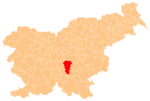
Obolno (pronounced [ɔˈboːu̯nɔ], German: Obounu or Obunu) is a small dispersed settlement in the hills north of Stična in the Municipality of Ivančna Gorica in central Slovenia. The area is part of the historical region of Lower Carniola. The municipality is now included in the Central Slovenia Statistical Region.
Name
The name Obolno follows an adjectival declension (gen Obolnega, loc na Obolnem). It is believed to derive from Common Slavic *abolьnъ 'apple', referring to the local vegetation. In the local dialect, the name is pronounced abau̯nə̏ (gen abúnəga, loc na abúnəm).
Cultural heritage
A small roadside chapel-shrine in the settlement dates to the early 20th century.
References
- Statistical Office of the Republic of Slovenia Archived November 18, 2008, at the Wayback Machine
- ^ Jakopin, Franc; Korošec, Tomo; Logar, Tine; Rigler, Jakob; Savnik, Roman; Suhadolnik, Stane (1985). Slovenska krajevna imena. Ljubljana: Cankarjeva založba. p. 185.
- ^ Bezlaj, France (1977). Etimološki slovar slovenskega jezika. Vol. 1. Ljubljana: Slovenska akademija znanosti in umetnosti. p. 215.
- ^ Bezlaj, France (1975). "Onomastika v etimoloških slovarjih". Onomastica Jugoslavica. 5: 3–8.
- Ivančna Gorica municipal site
- "EŠD 18127". Registry of Immovable Cultural Heritage (in Slovenian). Ministry of Culture of the Republic of Slovenia. Retrieved 29 August 2011.
External links
 Media related to Obolno at Wikimedia Commons
- Obolno on Geopedia
This article about the Municipality of Ivančna Gorica in Slovenia is a stub. You can help Misplaced Pages by expanding it. |
