| Orăștie | |
|---|---|
 Orăștie River Orăștie River | |
 | |
| Location | |
| Country | Romania |
| Counties | Hunedoara County |
| Communes | Orăștioara de Sus, Beriu, Orăștie |
| Physical characteristics | |
| Source | Mount Zebru |
| • location | Șureanu Mountains |
| • coordinates | 45°39′36″N 23°23′11″E / 45.66000°N 23.38639°E / 45.66000; 23.38639 |
| • elevation | 1,451 m (4,760 ft) |
| Mouth | Mureș |
| • location | near Orăștie |
| • coordinates | 45°52′48″N 23°10′57″E / 45.88000°N 23.18250°E / 45.88000; 23.18250 |
| • elevation | 195 m (640 ft) |
| Length | 51 km (32 mi) |
| Basin size | 399 km (154 sq mi) |
| Discharge | |
| • location | Orăștie |
| • average | 2.00 m/s (71 cu ft/s) |
| Basin features | |
| Progression | Mureș→ Tisza→ Danube→ Black Sea |
| Tributaries | |
| • right | Sibișel |
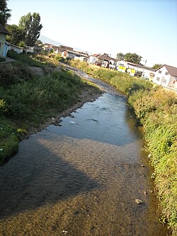
The Orăștie is a left tributary of the river Mureș in Romania. It discharges into the Mureș near the town Orăștie. Its length is 51 km (32 mi) and its basin size is 399 km (154 sq mi).
The upper reach of the river is also known as Godeanu. The middle reach is locally known as Grădiștea or Beriu. The lower reach, downstream of the confluence with the Sibișel is known as Apa Orașului (Hungarian: Városvíz, meaning "Townwater")
Tributaries
The following rivers are tributaries to the river Orăștie (from source to mouth):
- Left: Șes, Valea lui Brad, Valea Largă, Pustiosu, Pietrosu, Feierag
- Right: Pârâul Alb, Anineș, Valea Rea, Valea Muții, Sibișel
References
- "Planul național de management. Sinteza planurilor de management la nivel de bazine/spații hidrografice, anexa 7.1" (PDF, 5.1 MB). Administrația Națională Apele Române. 2010. pp. 410–411.
- ^ Atlasul cadastrului apelor din România. Partea 1 (in Romanian). Bucharest: Ministerul Mediului. 1992. pp. 176–117. OCLC 895459847. River code: IV.1.114
- Orastie / Gradiste, Godeanu (jud. Hunedoara), e-calauza.ro
This article related to a river in Hunedoara County is a stub. You can help Misplaced Pages by expanding it. |