| Ossipee River | |
|---|---|
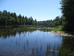
 The Ossipee River in Freedom, New Hampshire The Ossipee River in Freedom, New Hampshire | |
   | |
| Location | |
| Country | United States |
| States | New Hampshire, Maine |
| Counties | Carroll, NH; Oxford, ME; York, ME |
| Towns | Effingham, NH; Freedom, NH; Parsonsfield, ME; Porter, ME; Hiram, ME; Cornish, ME |
| Physical characteristics | |
| Source | Ossipee Lake |
| • location | Effingham Falls, NH |
| • coordinates | 43°47′38″N 71°3′48″W / 43.79389°N 71.06333°W / 43.79389; -71.06333 |
| • elevation | 407 ft (124 m) |
| Mouth | Saco River |
| • location | Cornish, ME |
| • coordinates | 43°48′49″N 70°46′58″W / 43.81361°N 70.78278°W / 43.81361; -70.78278 |
| • elevation | 275 ft (84 m) |
| Length | 18.3 mi (29.5 km) |
| Basin features | |
| Tributaries | |
| • left | Cold Brook, Mill Brook, Ridlon Brook, Wadsworth Brook |
| • right | South River, Great Brook, Wedgwood Brook, Little River |
The Ossipee River is an 18.3-mile-long (29.5 km) river in eastern New Hampshire and western Maine in the United States. It is a tributary of the Saco River, which flows southeast to the Atlantic Ocean at Saco, Maine.
The Ossipee River begins at the village of Effingham Falls, New Hampshire, at the outlet of Berry Bay, the farthest downstream of a chain of lakes connected to Ossipee Lake. The river, flowing east, forms the border between the towns of Effingham and Freedom. Entering Maine, the river continues to serve as a municipal boundary, first between Porter and Parsonsfield, and then between Hiram and Cornish. The river also forms the boundary between York County to the south and Oxford County to the north. Kezar Falls, a village in the town of Porter, forms a significant community along the river, with two dam impoundments.
Route 25 (New Hampshire and Maine) follows the river for its entire length.
See also
- Little Ossipee River, a separate tributary of the Saco River
- List of rivers of New Hampshire
- List of rivers of Maine
References
- U.S. Geological Survey. National Hydrography Dataset high-resolution flowline data. The National Map, accessed June 30, 2011
- New Hampshire GRANIT state geographic information system
| Rivers of Maine by drainage system | |||||||||||||||||||||||||||||||
|---|---|---|---|---|---|---|---|---|---|---|---|---|---|---|---|---|---|---|---|---|---|---|---|---|---|---|---|---|---|---|---|
| Bay of Fundy |
| ||||||||||||||||||||||||||||||
| Casco Bay |
| ||||||||||||||||||||||||||||||
| Gulf of Maine |
| ||||||||||||||||||||||||||||||
| Merrymeeting Bay |
| ||||||||||||||||||||||||||||||
| Muscongus Bay |
| ||||||||||||||||||||||||||||||
| Penobscot Bay |
| ||||||||||||||||||||||||||||||
| Saco Bay |
| ||||||||||||||||||||||||||||||
| Rivers of New Hampshire by drainage system | |||||||||||
|---|---|---|---|---|---|---|---|---|---|---|---|
| Gulf of Maine |
| ||||||||||
| Long Island Sound |
| ||||||||||
This article related to a river in New Hampshire is a stub. You can help Misplaced Pages by expanding it. |
This article related to a river in Maine is a stub. You can help Misplaced Pages by expanding it. |