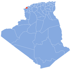
| Aïn Témouchent Province | |
|---|---|
 Map of Algeria highlighting Aïn Témouchent Map of Algeria highlighting Aïn Témouchent | |
| Coordinates: 35°18′N 01°08′W / 35.300°N 1.133°W / 35.300; -1.133 |
Oued el Maleh, Oued el Malah, Wadi el Maleh, etc. (Arabic: وادي المالح) is a wadi in Aïn Témouchent Province, Algeria. The name literally means "Salty Wadi". It was known in the past in Spanish as Rio Salado or "Salty River".
Oued el Maleh is in the northwest part of Algeria and drains into the Mediterranean Sea at about 35°26′32″N 1°14′13″W / 35.442169°N 1.236836°W / 35.442169; -1.236836 within Terga Municipality. Its watershed covers much of the province and is of elongated shape with an area of 932.56 km. approximately between 1°9’24’’ and 1°26’17’’W of longitude and between 35°17’22’’ and 35°16’37’’N of latitude and maximal altitude of 808m in the south. The climate is semi-arid Mediterranean.
References
- ^ "Analysis of the suspended sediment yield at different time scales in Mediterranean watershed, case of Wadi El Maleh (North-West of Algeria)", Journal of Mediterranean Earth Sciences 11 (2019), doi:10.3304/JMES.2019.001
- Bentekhici Nadjla, "La Contribution d’un SIG et l’Imagerie Spatiale dans la Présélection des Sites Adéquats pour le Stockage des Déchets Solides Urbains, Cas du Bassin de Oued El Maleh" (linked from here, Bulletin des Sciences Géographiques, no. 18, (October 2006) )
This article related to a river in Algeria is a stub. You can help Misplaced Pages by expanding it. |