| This article needs additional citations for verification. Please help improve this article by adding citations to reliable sources. Unsourced material may be challenged and removed. Find sources: "Oyabe, Toyama" – news · newspapers · books · scholar · JSTOR (May 2017) (Learn how and when to remove this message) |
| Oyabe 小矢部市 | |
|---|---|
| City | |
 Oyabe City Hall Oyabe City Hall | |
 Flag Flag | |
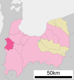
 Location of Oyabe in Toyama Prefecture Location of Oyabe in Toyama Prefecture | |
 | |
| Coordinates: 36°40′31.9″N 136°52′7.3″E / 36.675528°N 136.868694°E / 36.675528; 136.868694 | |
| Country | |
| Region | Chūbu |
| Prefecture | |
| Government | |
| • Mayor | Morio Sakurai |
| Area | |
| • Total | 134.07 km (51.76 sq mi) |
| Population | |
| • Total | 30,328 |
| • Density | 230/km (590/sq mi) |
| Time zone | UTC+9 (JST) |
| Postal code | 932-8611 |
| Symbols | |
| • Tree | Cryptomeria japonica |
| • Flower | Iris ensata |
| • Flowering tree | Prunus mume |
| Phone number | 0766-67-1760 |
| Address | 1-1 Honmachi, Oyabe-shi, Toyama-ken |
| Website | Official website |
Oyabe (小矢部市, Oyabe-shi) is a city in Toyama Prefecture, Japan. As of 31 March 2018, the city had an estimated population of 30,328 in 10,331 households. and a population density of 230 persons per km. Its total area was 134.07 square kilometres (51.76 sq mi).
Geography
Oyabe is in the Tonami flatlands of far western Toyama Prefecture, and is bordered by Ishikawa Prefecture to the west. Much of the area is a dispersed settlement typical of this region of Japan. Oyabe has a humid continental climate (Köppen Cfa) characterized by mild summers and cold winters with heavy snowfall. The average annual temperature in Oyabe is 14.0 °C. The average annual rainfall is 2454 mm with September as the wettest month. The temperatures are highest on average in August, at around 26.7 °C, and lowest in January, at around 2.7 °C.
Surrounding municipalities
Demographics
Per Japanese census data, the population of Oyabe has declined in recent decades.
| Year | Pop. | ±% |
|---|---|---|
| 1970 | 35,367 | — |
| 1980 | 36,497 | +3.2% |
| 1990 | 36,374 | −0.3% |
| 2000 | 34,625 | −4.8% |
| 2010 | 32,067 | −7.4% |
| 2020 | 28,983 | −9.6% |
History
The area of present-day Oyabe was part of ancient Etchū Province and developed as a post station on the Hokuriku kaidō highway during the Edo period. The town of Isurugi was created with the establishment of the municipalities system on April 1, 1889. It was raised to city status upon merging with the town of Tochu on August 1, 1962, and was renamed Oyabe.
Government
Oyabe has a mayor-council form of government with a directly elected mayor and a unicameral city legislature of 16 members.
Education
Oyabe has five public elementary schools and four public junior high schools operated by the town government, and three public high schools operated by the Toyama Prefectural Board of Education.
Transportation
Railway
Highway
Local attractions
- Oyabe Yotaka - adapted from a traditional field festival, it is held on the nights of 10 and 11 June. The festival is 400 years old and has been passed down from generation to generation in 84 different locations in Oyabe.
- Helicopter and Disaster Prevention Festival, held from 26–27 August
- Calamus Festival (Flower Festival), held on 18 June
- Mitsui Outlet Park, Hokuriku Oyabe
Notable people from Oyabe
- Hiroshi Hase, Japan's Minister of Education, Culture, Sports, Science and Technology
- Toshio Yamada, politician
External links
![]() Oyabe travel guide from Wikivoyage
Oyabe travel guide from Wikivoyage
- Official website (in Japanese)
- Official Oyabe Festival website (in Japanese)
References
- Official home page statistics(in Japanese)
- Oyabe climate data
- Oyabe population statistics
- Official home page address list of schools(in Japanese)
| Toyama (capital) | ||
| Core city | ||
| Cities | ||
| Districts | ||
| Former Districts | ||
| List of mergers in Toyama Prefecture | ||