| Paraibuna | |
|---|---|
| Municipality | |
 Flag Flag Coat of arms Coat of arms | |
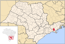
 Location in São Paulo state Location in São Paulo state | |
 | |
| Coordinates: 23°23′10″S 45°39′44″W / 23.38611°S 45.66222°W / -23.38611; -45.66222 | |
| Country | Brazil |
| Region | Southeast |
| State | São Paulo |
| Metrop. region | Vale do Paraíba e Litoral Norte |
| Area | |
| • Total | 809.58 km (312.58 sq mi) |
| Elevation | 635 m (2,083 ft) |
| Population | |
| • Total | 18,263 |
| • Density | 23/km (58/sq mi) |
| Time zone | UTC−3 (BRT) |
| Postal code | 12260-xxx |
| Area code | +55-12 |
| Website | www |
Paraibuna is a municipality (município) in the state of São Paulo in Brazil. It is part of the Metropolitan Region of Vale do Paraíba e Litoral Norte. The population is 18,263 (2020 est.) in an area of 809.58 km². The elevation is 635 m. The SP-99 highway passes through the town.
The municipality contains part of the 292,000 hectares (720,000 acres) Mananciais do Rio Paraíba do Sul Environmental Protection Area, created in 1982 to protect the sources of the Paraíba do Sul river.
History
| This section does not cite any sources. Please help improve this section by adding citations to reliable sources. Unsourced material may be challenged and removed. (October 2008) (Learn how and when to remove this message) |
The city was founded on June 13, 1666, with the construction of a hut and a chapel in honor of St. Anthony. On June 3, 1773 Manuel Antonio assumed the administration of the settlement Santo Antonio da Barra de Paraibuna. In 1812 the parish was established by the Prince Regent, and made a village, which was raised to a town in 1857. From 1830 to 1870 the area was known for its coffee plantations, and many farms, including the Fazenda São Pedro, were created for that purpose. With the decline of coffee plantations, farmers started to grow cotton. During this time Paraibuna began its financial decline.
A fresh impetus came to the county with the initiation of dairy-cattle breeding since 1922. Other economic progress derived from the construction of the President Dutra Freeway (Rio de Janeiro to São Paulo) and the Tamoios Highway. Construction of the Paraibuna-Paraitinga Dam in the 1960s brought new difficulties to the community: the inundation of prime land and the exodus of agricultural workers. Today the county invests in tourism in order to improve its economy.
Media
In telecommunications, the city was served by Companhia de Telecomunicações do Estado de São Paulo until 1975, when it began to be served by Telecomunicações de São Paulo. In July 1998, this company was acquired by Telefónica, which adopted the Vivo brand in 2012.
The company is currently an operator of cell phones, fixed lines, internet (fiber optics/4G) and television (satellite and cable).
References
- IBGE 2020
- Assembleia Legislativa do Estado de São Paulo, Lei Complementar Nº 1.166
- Instituto Brasileiro de Geografia e Estatística
- Unidade de Conservação: Área de Proteção Ambiental Bacia Hidrográfica do Paraíba do Sul (in Portuguese), MMA: Ministério do Meio Ambiente, retrieved 2016-10-01
- "Creation of Telesp - April 12, 1973". www.imprensaoficial.com.br (in Portuguese). Retrieved 2024-05-26.
- ^ "Our History - Telefônica RI". Telefônica. Retrieved 2024-05-26.
External links
- (in Portuguese) https://web.archive.org/web/20051211232800/http://www.paraibuna.sp.gov.br/
- (in Portuguese) citybrazil.com.br
- (in Portuguese) Paraibuna on Explorevale
| Places adjacent to Paraibuna | ||||||||||||||||
|---|---|---|---|---|---|---|---|---|---|---|---|---|---|---|---|---|
| ||||||||||||||||
This geographical article relating to the state of São Paulo is a stub. You can help Misplaced Pages by expanding it. |