| This article may require cleanup to meet Misplaced Pages's quality standards. The specific problem is: The first two references need fixing. Please help improve this article if you can. (July 2020) (Learn how and when to remove this message) |
| Pavlovo | |
|---|---|
| Village | |
 Flag Flag Coat of arms Coat of arms | |
  | |
| Coordinates: 48°38′52″N 22°54′54″E / 48.64778°N 22.91500°E / 48.64778; 22.91500 | |
| Country | |
| Oblast | Zakarpattia Oblast |
| Raion | Svaliava Raion |
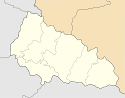
Pavlovo (Ukrainian: Павлово; Hungarian: Kispálos) is a village in Svaliava Raion (district) of Zakarpattia Oblast (province) in western Ukraine. It had a population of 770, according to the 2001 census.
The village is located 17 miles from Mukachevo and 8 miles from Svaliava.
According to the Ukrainian Census, about 99% of the population speak the Ukrainian language as a native language, while 0.13% speak Russian and 0.13% speak Belorussian. Pavlovo had a Jewish community with a population of 71 in 1880. The Jewish community was eliminated during the Holocaust, primarily through forced labor battalions and deportation to Auschwitz concentration camp.
References
- ^ "Перепис населення".
- "JewishGen Locality Page - Pavlovo, Ukraine". www.jewishgen.org. Retrieved 2021-06-28.
- "Pavlovo (Kispálos, Pavlová), Ukraine KehilaLink". kehilalinks.jewishgen.org. Retrieved 2020-07-20.
External links
- History of the villages of Pavlovo and Rodnikova Huta
- Solomonovo (Соломоновo) of Ukraine 1:100,000 topographic maps
This article about a location in Zakarpattia Oblast is a stub. You can help Misplaced Pages by expanding it. |