| This article includes a list of general references, but it lacks sufficient corresponding inline citations. Please help to improve this article by introducing more precise citations. (June 2014) (Learn how and when to remove this message) |
| Penarth Dock | |
|---|---|
 Remaining buildings re-used for retail, 2014 Remaining buildings re-used for retail, 2014 | |
| General information | |
| Location | Penarth, Vale of Glamorgan Wales |
| Grid reference | ST176725 |
| Platforms | 2 |
| Other information | |
| Status | Disused |
| History | |
| Original company | Taff Vale Railway |
| Pre-grouping | Taff Vale Railway |
| Post-grouping | Great Western Railway |
| Key dates | |
| 20 February 1878 | opened as Penarth Dock and Harbour |
| 28 January 1928 | renamed Penarth Dock |
| January 1962 | closed |
Penarth Dock railway station served the docks area of Penarth.
Description

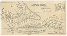
The Taff Vale Railway built its line to Penarth in 1865, later extending it to Lavernock, Sully and Cadoxton. Penarth Dock and Harbour station opened in 1878. The name was changed to Penarth Dock in 1928. The station was staffed and had two platforms with substantial buildings, linked by a footbridge. Despite this, it was very quiet during the day, and received almost all its revenue from morning and evening rush hour trains. It was closed on Sundays.
Closure
The station closed in January 1962. Most of the buildings are still present, and have been used by a range of businesses, including a shooting range, a garden centre, a second-hand car lot and a marine chandlers. The line is still open as far as Penarth, though it has been single track since 1967.
| Preceding station | Disused railways | Following station | ||
|---|---|---|---|---|
| Llandough Platform | Great Western Railway Taff Vale |
Dingle Road |
See also
References
- Quick, M. E. (2002). Railway passenger stations in England, Scotland and Wales – a chronology. Richmond: Railway and Canal Historical Society. p. 335. OCLC 931112387.
- Ings, D. (2009). Penarth Through Time. Amberley Publishing. ISBN 978-1848687462.
External links
- "Penarth Dock station in 1960". Flickr.com.
51°26′46″N 3°11′15″W / 51.446013°N 3.187496°W / 51.446013; -3.187496
Categories: