| Pilawit'u | |
|---|---|
 | |
   | |
| Location | Cono Sur, Vacas Municipality, Cochabamba Department, Arani Province |
| Coordinates | 17°35′50″S 65°34′10″W / 17.59722°S 65.56944°W / -17.59722; -65.56944 |
| Basin countries | Bolivia |
| Surface area | 2.0 km (0.77 sq mi) |
| Surface elevation | 3,407 m (11,178 ft) |
| Settlements | Vacas, Pilawit'u, Parirun |
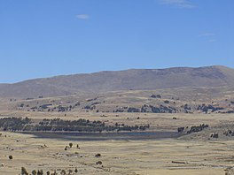
Pilawit'u is a Bolivian lake located in Vacas Municipality, Arani Province, Cochabamba Department. The last four thousand years of environmental and vegetation change has been recently reconstructed from the lake sediments of Pilawit'u (Lake Challacaba)
The main tributaries of Pilawit'u are Chiwalaki, Challa Q'awa, Muña Mayu and Phaqcha Pata Mayu whose tributaries are T'utura Mayu, Phaqcha Pata and the Phaqcha River. Its surface area is 2.0 km (0.77 sq mi).
See also
References
- Williams JJ, Gosling WD, Coe AL, Brooks SJ (2011). "Four thousand years of environmental change and human activity in the Cochabamba basin, Bolivia". Quaternary Research. 76 (1): 58–68. Bibcode:2011QuRes..76...58W. doi:10.1016/j.yqres.2011.03.004. S2CID 140662492.
- rincondelvago.com
This Cochabamba Department location article is a stub. You can help Misplaced Pages by expanding it. |