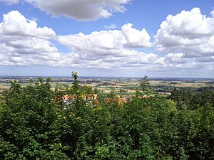
The Plain of Flanders (fr: Plaine de Flandre or plaine flamande) is a low-lying plain bordering the North Sea. It is part of the Low Countries, and the North European Plain. It extends through the territories of Northern France and Belgium. It has two main sections : Maritime Flanders and Interior Flanders. The coastal plain consists mainly of sand dunes and polders.
It is a feature of the Flanders Basin (fr: Bassin de Flandre), which is separated from the Parisian Basin by the Hills of Artois.
It is a formation dating the Cenozoic era.
Maritime Flanders also refers to the French Westhoek region. It refers more specifically to the Blootland (Dutch for "naked land") or the Maritime Plain (French: Plaine maritime) including Dunkirk, Bourbourg, Bergues and Hondschoote.


See also
References
- La Flandre: étude géographique de la plaine flamande en France, Belgique et Hollande. R Blanchard, 1906
- Les changements du niveau de la mer dans la plaine maritime flamande pendant l'Holocene. R Tavernier, F Moormann, Geol. Mijnbouw, 1954
This European geography article is a stub. You can help Misplaced Pages by expanding it. |