| Planjava | |
|---|---|
 Planjava Planjava | |
| Highest point | |
| Elevation | 2,394 m (7,854 ft) |
| Prominence | 530 m (1,740 ft) |
| Coordinates | 46°21′23.51″N 14°36′36.02″E / 46.3565306°N 14.6100056°E / 46.3565306; 14.6100056 |
| Geography | |
 | |
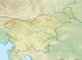
| Location | Slovenia |
| Parent range | Kamnik–Savinja Alps |
Planjava (2,394 meters or 7,854 feet) is the highest mountain of the eastern Kamnik Alps in northern Slovenia. On the western side there is a steep wall over the Kamniško sedlo pass, on the eastern side runs a long ridge and on the northern side there is an almost 1,000-meter (3,300 ft) high wall above the Logar Valley.
History of climbing
The first recorded climb was by Franz Hohenwart in 1793 with a local from Kamniška Bistrica, although it is speculated that there were local hunters who climbed the mountain before them. Planjava is now one of the most visited peaks in Slovenia.
Routes
- 2 hrs from the Kamnik Saddle Lodge
- 1½ hrs from the Kocbek Lodge at Korošica
- 2½ hrs from the Kocbek Lodge at Korošica above Lučka Baba
- 5¼ hrs from the Klemenšek Cave Lodge at Ojstrica
Climbing routes
Southeastern wall
- Memorial route Štefana Kukovca (VI/V, 350 meters or 1,150 feet)
- Route Humar - Škarja (V-/IV, 270 meters or 890 feet)
- Route Sobotna smer (V+/IV+, 210 meters or 690 feet)
Western wall
- Route Steber Planjave - smer X (IV, 400 meters or 1,300 feet)
- Route Svetelova (IV/III, 170 meters or 560 feet)
- Route Smer skozi rov in okno (IV/III-II, 300 meters or 980 feet)
- Route Kratkohlača (V-/IV, 310 meters or 1,020 feet)
Northern wall
- Route Gradišnik - Ogrin (V-/IV, 700 meters or 2,300 feet)
- Route Dular - Juvan v Glavi (VII, 200 meters or 660 feet)
References
- "Planjava - peakbagger". peakbagger.com. Retrieved 17 February 2015.
External links
| Kamnik–Savinja Alps | ||
|---|---|---|
| Main peaks |  | |