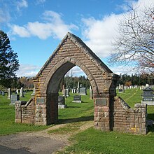
Point de Bute is an area in ward five of the town of Tantramar in Westmorland County, New Brunswick, Canada.
The former local service district of Pointe de Bute took its name from the community but used a different spelling.
History

The Acadian Pierre Buhot settled here in the late 1600s, and the original name was Pont à Buhot which evolved, via Pont à Buot to the current name. Opposite his house was a bridge over the Missaguash River, leading to the Tantramar Marsh. It was near the outlet of a stream, Rivière à l'Ours and a redoubt, which was the first point of attack by Monckton's army in 1755 as it advanced from Fort Lawrence to cross the Missaguash river on the way to attack Fort Beausejour.
Notable people
Main article: List of people from Westmorland County, New Brunswick- Point de Bute is the birthplace of the British Columbian transportation pioneer Stephen Tingley,
- birth place of World War I flying ace Albert Desbrisay Carter, and the scientist Edwin Colpitts.
- home of Thomas Dixson
See also
References
- Webster, J. Clarence (1947). Historical Guide to New Brunswick. New Brunswick Government Bureau of Information and Tourist Travel. p. 50.
| Subdivisions of New Brunswick | |
|---|---|
| Cities | |
| Towns |
|
| Villages | |
| Regional municipality | |
| Rural communities | |
| Rural districts |
|
| Regional service commissions | |
| School districts | |
| Indian reserves |
|
| Non-administrative divisions | |
45°53′58″N 64°14′35″W / 45.89938°N 64.24311°W / 45.89938; -64.24311 (Point de Bute)
This New Brunswick location article is a stub. You can help Misplaced Pages by expanding it. |