| Psefir | |
|---|---|
   | |
| Physical characteristics | |
| Mouth | Fars |
| • coordinates | 44°36′17″N 40°28′31″E / 44.60472°N 40.47528°E / 44.60472; 40.47528 |
| Length | 67 km (42 mi) |
| Basin size | 378 km (146 sq mi) |
| Basin features | |
| Progression | Fars→ Laba→ Kuban→ Sea of Azov |
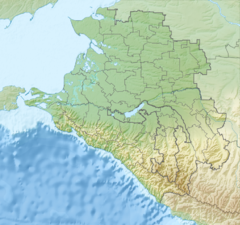
The Psefir (Russian: Псефирь) is a river in Krasnodar Krai, Russia, which flows into the Fars. It is 67 kilometres (42 mi) long, and has a drainage basin of 378 square kilometres (146 sq mi). The area around the river is populated by various Abadzekh and Circassian tribes. The stanitsa of Kostromskaya stands on the river.
References
- "Река Псефирь (Псефир) in the State Water Register of Russia". textual.ru (in Russian).
This Krasnodar Krai location article is a stub. You can help Misplaced Pages by expanding it. |
This article related to a river in Southern Russia is a stub. You can help Misplaced Pages by expanding it. |