| Puerto Castilla Airport | |||||||||||
|---|---|---|---|---|---|---|---|---|---|---|---|
| Summary | |||||||||||
| Airport type | Closed | ||||||||||
| Location | Puerto Castilla, Honduras | ||||||||||
| Coordinates | 16°00′30″N 85°58′05″W / 16.00833°N 85.96806°W / 16.00833; -85.96806 | ||||||||||
| Map | |||||||||||
 | |||||||||||
| Runways | |||||||||||
| |||||||||||
| Sources: Google Maps HERE Maps GCM | |||||||||||
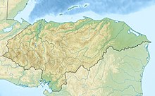
Puerto Castilla Airport (ICAO: MHCT) was an airport formerly serving Puerto Castilla, a municipality in Colón Department, Honduras.
Aerial imaging shows the western end of the paved runway built over by buildings and storage from the Puerto Castilla container port, leaving only 200 metres (660 ft) of runway plus the aircraft turnaround on the eastern end.
See also
References
- ^ Google Maps - Puerto Castilla
- ^ HERE Maps - Puerto Castilla
- Airport information for MHCT at Great Circle Mapper.
External links
| Main airports in Honduras | |
|---|---|
This article about a Central American airport is a stub. You can help Misplaced Pages by expanding it. |