| This article needs additional citations for verification. Please help improve this article by adding citations to reliable sources. Unsourced material may be challenged and removed. Find sources: "Rahara" – news · newspapers · books · scholar · JSTOR (October 2021) (Learn how and when to remove this message) |
Village in Connacht, Ireland
| Rahara Ráth Ara | |
|---|---|
| Village | |
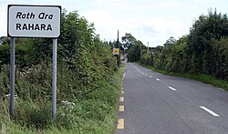
 Rahara on the R362 Rahara on the R362 | |
 | |
| Coordinates: 53°31′16″N 8°08′24″W / 53.521°N 8.140°W / 53.521; -8.140 | |
| Country | Ireland |
| Province | Connacht |
| County | County Roscommon |
| Time zone | UTC+0 (WET) |
| • Summer (DST) | UTC-1 (IST (WEST)) |
Rahara (Irish: Ráth Ara, meaning 'fort of the charioteer') is a village in County Roscommon, Ireland. It lies on the R362 regional road, between Athlone and Athleague about 3 km (1.9 mi) north of the village of Curraghboy. Rahara is in a townland and civil parish of the same name.
As of December 2011, the local primary school, Rahara National School, had an enrollment of 34 children. The Roman Catholic church in Rahara, the Church of Mary Immaculate, is in the combined parish of Knockcroghery, St. John's and Rahara of the Diocese of Elphin.
See also
References
- ^ "Ráth Ara/Rahara". logainm.ie. Placenames Database of Ireland. Retrieved 14 October 2021.
- "Whole School Evaluation Report - Rahara National School". gov.ie. Department of Education. 6 December 2011. Retrieved 26 February 2022.
- "Parish Details - Knockcroghery / St. John's / Rahara". elphindiocese.ie. Diocese of Elphin. Retrieved 26 February 2022.

