Human settlement in England
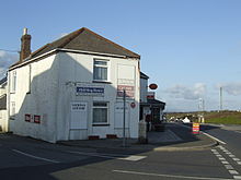
Rame (Cornish: Hordh) is a small village approximately three miles west of Penryn and five miles northeast of Helston in Cornwall, England, UK. It is located on the A394 main road.
The tenement of Rame has for generations been in the possession of the Williams family of Scorrier.
Cornish wrestling
Cornish wrestling tournaments were held in a field adjoining Halfway House farm.

References
- Ordnance Survey One-inch Map of Great Britain; Truro and Falmouth, sheet 190. 1961
- Langdon, A. G. (1896) Old Cornish Crosses. Truro: Joseph Pollard; p. 333
- Royal Cornwall Gazette, 14 August 1875.
| Cornwall Portal | |
| Unitary authorities | |
| Major settlements (cities in italics) |
|
| Rivers | |
| Topics | |
This article about a location in the former district of Kerrier, Cornwall is a stub. You can help Misplaced Pages by expanding it. |
