| Rancho Santa Inés Airstrip | |||||||||||
|---|---|---|---|---|---|---|---|---|---|---|---|
| Summary | |||||||||||
| Airport type | Public | ||||||||||
| Operator | N/A | ||||||||||
| Location | Cataviña, Mexico | ||||||||||
| Elevation AMSL | 1,865 ft / 568 m | ||||||||||
| Coordinates | 29°43′35″N 114°42′03″W / 29.72639°N 114.70083°W / 29.72639; -114.70083 | ||||||||||
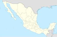
| Map | |||||||||||
 | |||||||||||
| Runways | |||||||||||
| |||||||||||
Rancho Santa Inés Airstrip (ICAO: MM23), also known as Cataviña Airstrip, is a public airstrip located South of Cataviña, Municipality of Ensenada, Baja California, Mexico, just in the middle of the Cataviña Desert National Reserve. The airfield is used solely for general aviation purposes. The ranch offers rooms and bunkhouse accommodations for the night as well as food. The ruins of Mission Santa Maria are 23 km (14 mi) further east on a poorly maintained dirt road.
External links
- CTV at Airport List.
- CTV at The Airport Guide.
- Baja Bush Pilots forum about CTV.
- Info about Cataviña, BC.
This article about a Mexican airport is a stub. You can help Misplaced Pages by expanding it. |