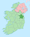
Village in Leinster, Ireland
| Rathmolyon Ráth Moliain | |
|---|---|
| Village | |
 St. Michael's and All Angels Church, Rathmolyon St. Michael's and All Angels Church, Rathmolyon | |
 | |
| Coordinates: 53°29′20.4″N 6°44′40.2″W / 53.489000°N 6.744500°W / 53.489000; -6.744500 | |
| Country | Ireland |
| Province | Leinster |
| County | County Meath |
| Elevation | 76 m (249 ft) |
| Population | 334 |
| Time zone | UTC+0 (WET) |
| • Summer (DST) | UTC-1 (IST (WEST)) |
| Irish Grid Reference | N833483 |
Rathmolyon (/ræθmɒˈlaɪn/; Irish: Ráth Moliain, meaning 'ringfort of the plain of St. Liadhain') is a village in the southern portion of County Meath, Ireland, situated 8 km south of Trim. It is situated at the junction of the R156 regional road and the R159 regional road connecting Trim to Enfield. Rathmolyon serves as a service centre for the surrounding rural area. The village is in a townland and civil parish of the same name.
Public transport
Bus Éireann route 115A provides a commuter link from Rathmolyon to Dublin via Summerhill and Dunboyne with one journey in the morning and an evening journey back every day except Sunday.
Local history
The village developed at the junction of two regional roads. A number of buildings in the village date from the Georgian and Victorian periods. During the late 19th century, the area played a role in the development of the Two by Twos and Cooneyite movement, the only religion known to have had its origin in Ireland.
Notable or historic buildings in Rathmolyon include a Catholic church, a Protestant church, two public houses, Cherryvalley House, Rathmolyon Villa and Rathmolyon House.
Development
The population of Rathmolyon almost doubled in the ten years between the 2006 census (168 inhabitants) and the 2016 census (334 people). According to the 2016 census, almost 50% of the town's houses (53 of 108 households) were constructed between 2001 and 2010.
The townland of Rathmolyon Esker, east of Rathmolyon, has been proposed as a Natural Heritage Area.
See also
References
- ^ "Sapmap Area - Settlements - Rathmolyon". Census 2016. Central Statistics Office. April 2016. Retrieved 17 February 2020.
- ^ "Ráth Moliain/Rathmolyon". Placenames Database of Ireland (logainm.ie). Retrieved 15 October 2021.
- "Christmas & New Year Travel Arrangements - Travel anywhere in Ireland by bus or coach with Bus Éireann e.g. Dublin, Cork, Galway, etc". Archived from the original on 29 December 2010.
- Dair Rioga Local History Group, Mallon and Greaney editors. 2005. All in Good Faith: A History of Christianity in Enfield, Rathmolyon, Rathcore and Associated Areas. Ireland: Dair Rioga Local History Group and the Meath Leader under the NRDP Programme of the Department of Community, Rural and Gaeltacht Affairs / National Development Plan.
- Robinson, James. 2005. Pentecostal Origins: Early Pentecostalism in Ireland in the Context of the British Isles: Studies in Evangelical History and Thought. Milton Keynes, United Kingdom: Paternoster, p. 34. ISBN 978-1-84227-329-6
- "Rathmolyon Draft Local Area Plan" (PDF). Meath County Council. 2008. Archived from the original (PDF) on 15 February 2012.
- "Rathmolyon (Ireland) Census Town". City Population. Retrieved 17 February 2020.
