Download coordinates as:
The Isle of Anglesey, a principal area off the north-west coast of Wales, includes the islands of Anglesey, Holy Island and some islets and skerries. It covers an area of 711 km (275 sq mi) and in 2021 the population was approximately 68,900.
The Cadw/ICOMOS Register of Parks and Gardens of Special Historic Interest in Wales was established in 2002 and given statutory status in 2022. It is administered by Cadw, the historic environment agency of the Welsh Government. Elisabeth Whittle described Cadw as having a "somewhat special and guiding role" in the preservation of historic parks and gardens, since they are "an integral part of Welsh archaeological and architectural heritage". The register includes just under 400 sites, ranging from gardens of private houses, to cemeteries and public parks. Parks and gardens are listed at one of three grades, matching the grading system used for listed buildings. Grade I is the highest grade, for sites of exceptional interest; Grade II*, the next highest, denotes parks and gardens of great quality; while Grade II denotes sites of special interest.
There are nine registered parks and gardens in Anglesey. One is listed at Grade I, five at Grade II* and three at Grade II.
Key
| Grade | Criteria |
|---|---|
| I | Parks and gardens of exceptional interest |
| II* | Parks and gardens of great quality |
| II | Parks and gardens of special interest |
List of parks and gardens
| Name | Location Grid Ref. Geo-coordinates |
Date Listed | Description / Notes | Grade | Reference Number | Image |
|---|---|---|---|---|---|---|
| Bodowen and Bodorgan | Bodorgan SH3728065830 53°09′53″N 4°26′08″W / 53.164652°N 4.435521°W / 53.164652; -4.435521 (Bodowen and Bodorgan) |
1 February 2022 | Park, American garden, country house garden and kitchen garden The relict garden at Bodowen dates to the early seventeenth-century during which time the estate is known to have had a deer park. Bodowen was absorbed by the adjacent Bodorgan estate in the nineteenth century. The terraced garden, American and walled gardens at Bodorgan date from the nineteenth century. Its parkland area is used for farmland and also has a deer park within it. | II* | PGW(Gd)44(ANG) | 
|
| Carreglwyd | Llanfaethlu SH3080587715 53°21′32″N 4°32′34″W / 53.358932°N 4.54275°W / 53.358932; -4.54275 (Carreglwyd) |
1 February 2022 | Park, kitchen garden and woodland garden The Georgian manor house and several other listed structures are set within a woodland garden with an informal ornamental lake, surrounded by the park of open grazed enclosures. The layout is nineteenth century but incorporates earlier design elements. The walled garden to the north of the house is eighteenth century with a later extension (pre-1891). | II* | PGW(Gd)43(ANG) | 
|
| Cestyll | Cylch-y-Garn SH3447393364 53°24′39″N 4°29′26″W / 53.41083°N 4.490651°W / 53.41083; -4.490651 (Cestyll) |
1 February 2022 | Country house garden A small and secluded 1920s garden whose owner and principal designer, Violet Vivian, was a friend of Princess Victoria who also designed part of the garden. The sheltered valley garden is informally planted a wide variety of trees and shrubs. There is a Grade II* listed corn mill near the garden and the area also includes the remains of the kitchen garden and the site of the house which was demolished in 1991. | II | PGW(Gd)45(ANG) | 
|
| Llanidan | Llanidan SH4951966934 53°10′40″N 4°15′07″W / 53.177913°N 4.251928°W / 53.177913; -4.251928 (Llanidan) |
1 February 2022 | Park, country house garden and walled garden Llanidan Hall and adjacent medieval Old Church of St Nidan (both grade II* listed) are set within a small but well-preserved eighteenth century landscape park that incorporates the circular churchyard and a holy well. A ha-ha defines the boundary between the park and garden. The walled garden, which was redesigned in the 1980s, is of early seventeenth-century origin. | II* | PGW(Gd)46(ANG) | 
|
| Plas Berw | Llanfihangel Ysgeifiog SH4660471822 53°13′16″N 4°17′52″W / 53.220992°N 4.297856°W / 53.220992; -4.297856 (Plas Berw) |
1 February 2022 | Deer Park, country house garden and walled garden The early seventeenth-century house and gardens are set within a deer park which may date to the fifteenth century. The park has been damaged by road and railway engineering: the B4419 runs along eastern boundary and a railway (built c. 1841) passes through the park. | II* | PGW(Gd)42(ANG) | 
|
| Plas Gwyn | Plas Gwyn SH5278078068 53°16′44″N 4°12′30″W / 53.278851°N 4.208317°W / 53.278851; -4.208317 (Plas Gwyn) |
1 February 2022 | Park, country house garden and walled garden The Georgian mansion was completed in 1754. The park and gardens are thought to be contemporary with this but with nineteenth century alterations made to the park. The house and several nearby buildings are listed, as are the gates and lodges at the south and north-east entrances. | II | PGW(Gd)47(ANG) | 
|
| Plas Newydd | Llanddaniel Fab SH5184969432 53°12′04″N 4°13′06″W / 53.201014°N 4.218252°W / 53.201014; -4.218252 (Plas Newydd) |
1 February 2022 | Park, country house garden and walled garden The large estate located on the west shore of the Menai Strait contains numerous listed buildings and two scheduled monuments (both are Neolithic burial chambers). The park was landscaped at the turn of the eighteenth and nineteenth centuries. To the north of the house is a formal garden with terraces, and to the south-west are the walled gardens. In the 1870s visitors could obtain tickets to visit the grounds with the proceeds going to a local charity. The property is now owned by the National Trust. | I | PGW(Gd)48(ANG) | 
|
| Plas Rhianfa | Cwm Cadnant SH5693373382 53°14′16″N 4°08′38″W / 53.237887°N 4.143955°W / 53.237887; -4.143955 (Plas Rhianfa) |
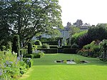
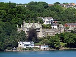
1 February 2022 | Country house garden The steeply sloping site was laid out in the mid-nineteenth century with formal terraces planted in a style reminiscent of the Mediterranean. Originally the site covered 12 acres (4.9 ha) but only a quarter of this remains, the rest having been sold off. The house (Grade II*) and the garden summer house and dovecote (Grade II) are listed buildings. | II | PGW(Gd)49(ANG) | 
|
| Ty Fry | Pentraeth SH5150476800 53°16′02″N 4°13′37″W / 53.267106°N 4.226847°W / 53.267106; -4.226847 (Ty Fry) |
1 February 2022 | Country house garden The seventeenth-century gentry house is set within a landscape of rocky outcrops that has been laid out with raised walks and rock-cut steps. There is a formal inner garden is to the north-west of the house and an informal outer garden to the south and west. There are numerous springs and to the north is an area that may once have been a formal water garden. | II* | PGW(Gd)66(ANG) | 
|
See also
- List of scheduled monuments in Anglesey
- Grade I listed buildings in Anglesey
- Grade II* listed buildings in Anglesey
Notes
- Sometimes known as OSGB36, the grid reference is based on the British national grid reference system used by the Ordnance Survey.
References
- "Sir Ynys Mon – Isle of Anglesey". Ordnance Survey. Retrieved 21 February 2023.
- "Isle of Anglessey - Population Density (QS102EW)". UKCensusdata.com. Archived from the original on 21 February 2023. Retrieved 21 February 2023.
- "Labour Market Profile - Isle of Anglesey". Nomis. Office for National Statistics. Retrieved 21 February 2023.
- "Historic Parks and Gardens". Cadw. Archived from the original on 9 March 2012.
- "Registered historic parks and gardens". Cadw. Retrieved 19 February 2023.
- Whittle 1992, p. 6.
- ^ "Understanding registered historic parks & gardens: 2. What is registration?". Cadw. Retrieved 19 February 2023.
- "Bodowen Parks, Anglesey (700170)". Coflein. RCAHMW. Retrieved 21 February 2023.
- "Bodowen Relict Garden, Anglesey (700171)". Coflein. RCAHMW. Retrieved 21 February 2023.
- "Bodorgan American Garden, Anglesey (700174)". Coflein. RCAHMW. Retrieved 21 February 2023.
- "Bodorgan Terraced Gardens and Grounds, Anglesey (265110)". Coflein. RCAHMW. Retrieved 21 February 2023.
- "Bodorgan Kitchen Gardens, Anglesey (700175)". Coflein. RCAHMW. Retrieved 21 February 2023.
- Cadw. "Bodowen and Bodorgan (PGW(Gd)44(ANG))". National Historic Assets of Wales. Retrieved 21 February 2023.
- "Carreglwyd Park, Llanfaethlu, Anglesey (700394)". Coflein. RCAHMW. Retrieved 21 February 2023.
- "Carreglwyd Kitchen Garden, Llanfaethlu, Anglesey (700395)". Coflein. RCAHMW. Retrieved 21 February 2023.
- "Carreglwyd Woodland Garden and Grounds, Llanfaethlu, Anglesey (301548)". Coflein. RCAHMW. Retrieved 21 February 2023.
- Cadw. "Carreglwyd (PGW(Gd)43(ANG))". National Historic Assets of Wales. Retrieved 21 February 2023.
- "Cestyll Garden, Cemaes (301555)". Coflein. RCAHMW. Retrieved 21 February 2023.
- Cadw. "Cestyll (PGW(Gd)45(ANG))". National Historic Assets of Wales. Retrieved 21 February 2023.
- Cadw. "Corn Mill at Felin Gafnan (24416)". National Historic Assets of Wales. Retrieved 21 February 2023.
- "Llanidan Hall Park, Brynsiencyn (700033)". Coflein. RCAHMW. Retrieved 21 February 2023.
- "Llanidan House Gardens, Brynsiencyn (265387)". Coflein. RCAHMW. Retrieved 21 February 2023.
- "Llanidan Hall Walled Garden, Brynsiencyn (15735)". Coflein. RCAHMW. Retrieved 21 February 2023.
- Cadw. "Llanidan (PGW(Gd)46(ANG))". National Historic Assets of Wales. Retrieved 21 February 2023.
- "Plas Berw Deer Park, Llangefni (700311)". Coflein. RCAHMW. Retrieved 21 February 2023.
- "Plas Berw Grounds, Llangefni (265407)". Coflein. RCAHMW. Retrieved 21 February 2023.
- "Plas Berw Walled Gardens, Llangefni (700336)". Coflein. RCAHMW. Retrieved 21 February 2023.
- Cadw. "Plas Berw (PGW(Gd)42(ANG))". National Historic Assets of Wales. Retrieved 21 February 2023.
- "Plas Gwyn Park, Pentraeth (700032)". Coflein. RCAHMW. Retrieved 21 February 2023.
- "Plas Gwyn Grounds and Gardens, Pentraeth (265411)". Coflein. RCAHMW. Retrieved 21 February 2023.
- "Plas Gwyn Walled Garden, Pentraeth (310108)". Coflein. RCAHMW. Retrieved 21 February 2023.
- Cadw. "Plas Gwyn (PGW(Gd)47(ANG))". National Historic Assets of Wales. Retrieved 21 February 2023.
- "Plas Newydd Park, Llanddaniel Fab (700029)". Coflein. RCAHMW. Retrieved 21 February 2023.
- "Plas Newydd Grounds and Gardens, Llanddaniel Fab (265416)". Coflein. RCAHMW. Retrieved 21 February 2023.
- "Plas Newydd Walled (Kitchen) Garden, Llanddaniel Fab (15826)". Coflein. RCAHMW. Retrieved 21 February 2023.
- Cadw. "Plas Newydd (PGW(Gd)48(ANG))". National Historic Assets of Wales. Retrieved 21 February 2023.
- Black 1872, p. 67.
- "Plas Newydd House and Garden". National Trust. Retrieved 14 March 2023.
- "Plas Rhianfa Garden, Menai Bridge (265428)". Coflein. RCAHMW. Retrieved 21 February 2023.
- Cadw. "Plas Rhianfa (PGW(Gd)49(ANG))". National Historic Assets of Wales. Retrieved 21 February 2023.
- "Ty-Fry Gardens and Grounds (265444)". Coflein. RCAHMW. Retrieved 21 February 2023.
- Cadw. "Ty Fry (PGW(Gd)66(ANG))". National Historic Assets of Wales. Retrieved 21 February 2023.
Bibliography
- Whittle, Elisabeth (1992). The Historic Gardens of Wales: An Introduction to Parks and Gardens in the History of Wales. Cardiff: Cadw. ISBN 978-0-117-01578-4.
- Black's Picturesque Guide to North Wales. Edinburgh: Adam and Charles Black. 1872.
| Cadw/ICOMOS Register of Parks and Gardens of Special Historic Interest in Wales | |
|---|---|
